|
search place name
|
||
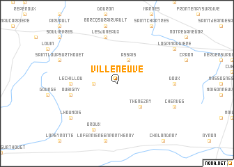
Villeneuve (Poitou-Charentes, France)Villeneuve is a town in the Poitou-Charentes region of France. An overview map of the region around Villeneuve is displayed below.
regional and 3d topo map of Villeneuve, France ::
Villeneuve airports ::
The nearest airport is PIS - Poitiers Biard, located 33.8 km south east of Villeneuve.
Other airports nearby include NIT - Niort Souche (55.1 km south west), CET - Cholet Le Pontreau (71.9 km north west), TUF - Tours Val De Loire (96.9 km north east), EDM - La Roche-sur-yon Les Ajoncs (100.4 km west), Nearby towns ::
Pressigny (2.5km west) //
Assais (3.9km north) //
Thénezay (4.5km south east) //
Lamaire (5.1km west) //
Le Chillou (5.1km west) //
Aubigny (5.4km west) //
Les Jumeaux (7.5km north) //
Oroux (7.8km south) //
Lhoumois (7.5km south west) //
[all distances 'as the bird flies' and approximate] 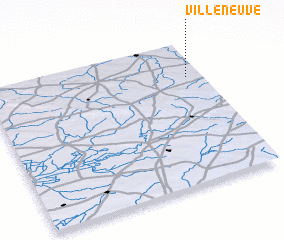 Places with similar names to Villeneuve, France ::
// Val'nëvo (RU)
// Villa Nueva (BO)
// Villa Nueva (BO)
// Villa Nueva (BO)
// Volynovo (RU)
// Vila Nova (PT)
// Vila Nova (PT)
// Vila Nova (PT)
// Vila Nova (PT)
// Vila Nova (PT)
Disclaimer :: Information on this page comes without warranty of any kind |
||
|
Where is Villeneuve? Elevation and coordinates ::
Latitude (lat): 46°45'0"N Longitude (lon): 0°4'0"W
Elevation (approx.): 139m (map arrows pan, magnifying glasses zoom) |
||
|
Visiting Villeneuve? Hotel/Accommodation ::
Book a hotel in Villeneuve Travel Guide ::
Buy a travel guide for France rental cars ::
car rental offers GPS waypoint ::
download a GPX waypoint (PoI) of Villeneuve for your GPS receiver
|
||