|
search place name
|
||
Villeneuve-de-Duras (Aquitaine, France)Villeneuve-de-Duras is a town in the Aquitaine region of France. An overview map of the region around Villeneuve-de-Duras is displayed below.
regional and 3d topo map of Villeneuve-de-Duras, France ::

Villeneuve-de-Duras airports ::
The nearest airport is EGC - Bergerac Roumaniere, located 24.8 km north east of Villeneuve-de-Duras.
Other airports nearby include AGF - Agen La Garenne (68.3 km south east), PGX - Perigueux Bassillac (69.1 km north east), BOD - Bordeaux Merignac (75.8 km west), XAC - Arcachon La Teste De Buch (107.7 km west), Nearby towns ::
Saint-Astier (2.3km south east) //
Saint-Sernin (3.7km south) //
Margueron (3.9km north) //
Savignac-de-Duras (4.5km south west) //
Riocaud (4.5km north west) //
Landerrouat (3.9km west) //
La Roquille (5.6km north) //
Loubès-Bernac (4.4km south east) //
Ligueux (6.2km north east) //
Esclottes (6.4km south west) //
Saint-André-et-Appelles (7.9km north) //
Duras (8.4km south west) //
Baleyssagues (7.7km south west) //
Saint-Jean-de-Duras (7.7km south east) //
Les Lèves-et-Thoumeyragues (8.4km north west) //
Razac-de-Saussignac (8.4km north east) //
[all distances 'as the bird flies' and approximate] 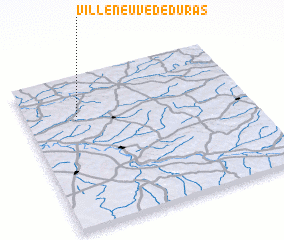 Places with similar names to Villeneuve-de-Duras, France :: Disclaimer :: Information on this page comes without warranty of any kind |
||
|
Where is Villeneuve-de-Duras? Elevation and coordinates ::
Latitude (lat): 44°44'0"N Longitude (lon): 0°14'0"W
Elevation (approx.): 74m (map arrows pan, magnifying glasses zoom) |
||
|
Visiting Villeneuve-de-Duras? Hotel/Accommodation ::
Book a hotel in Villeneuve-de-Duras Travel Guide ::
Buy a travel guide for France rental cars ::
car rental offers GPS waypoint ::
download a GPX waypoint (PoI) of Villeneuve-de-Duras for your GPS receiver
|
||