|
search place name
|
||
Villers-Franqueux (Champagne-Ardenne, France)Villers-Franqueux is a town in the Champagne-Ardenne region of France. An overview map of the region around Villers-Franqueux is displayed below.
regional and 3d topo map of Villers-Franqueux, France ::

Villers-Franqueux airports ::
The nearest airport is RHE - Reims Champagne, located 8.9 km east of Villers-Franqueux.
Other airports nearby include CSF - Creil (103.3 km west), CDG - Paris Charles De Gaulle (107.0 km west), QYR - Troyes Barberey (112.6 km south), LBG - Paris Le Bourget (116.1 km west), Nearby towns ::
Pouillon (2.2km south east) //
Cauroy-lès-Hermonville (2.2km north west) //
Hermonville (2.4km west) //
Chenay (3.7km south) //
Merfy (3.9km south) //
Thil (3.0km south east) //
Trigny (4.4km south west) //
Saint-Thierry (4.4km south east) //
Cormicy (4.4km north west) //
Châlons-sur-Vesle (5.7km south) //
Loivre (4.1km north east) //
Berméricourt (4.1km north east) //
Courcy (5.2km east) //
Champigny (7.8km south) //
Berry-au-Bac (7.8km north) //
Aguilcourt (7.8km north) //
Saint-Brice-et-Courcelles (8.3km south east) //
Courcelles (8.3km south east) //
Muizon (8.3km south west) //
Bertricourt (7.4km north east) //
La Neuvillette-lès-Reims (7.4km south east) //
Gernicourt (8.8km north west) //
[all distances 'as the bird flies' and approximate] 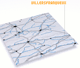 Places with similar names to Villers-Franqueux, France :: Disclaimer :: Information on this page comes without warranty of any kind |
||
|
Where is Villers-Franqueux? Elevation and coordinates ::
Latitude (lat): 49°20'0"N Longitude (lon): 3°56'0"E
Elevation (approx.): 92m (map arrows pan, magnifying glasses zoom) |
||
|
Visiting Villers-Franqueux? Hotel/Accommodation ::
Book a hotel in Villers-Franqueux Travel Guide ::
Buy a travel guide for France rental cars ::
car rental offers GPS waypoint ::
download a GPX waypoint (PoI) of Villers-Franqueux for your GPS receiver
|
||