|
search place name
|
||
Warlus (Nord-Pas-de-Calais, France)Warlus is a town in the Nord-Pas-de-Calais region of France. An overview map of the region around Warlus is displayed below.
regional and 3d topo map of Warlus, France ::

Warlus airports ::
The nearest airport is LIL - Lille Lesquin, located 43.2 km north east of Warlus.
Other airports nearby include QKT - Kortrijk-vevelgem Wevelgem (70.6 km north east), LTQ - Le Tourquet Le Touquet Paris Plage (78.8 km west), CQF - Calais Dunkerque (90.8 km north west), BVA - Beauvais Tille (100.4 km south west), Nearby towns ::
Berneville (1.9km south) //
Agnez-lès-Duisans (1.9km north) //
Duisans (2.2km north east) //
Simencourt (2.2km south west) //
Larresset (3.9km north) //
Gouves (3.0km north west) //
Étrun (4.4km north east) //
Maroeuil (4.4km north east) //
Dainville (3.6km east) //
Bray (5.7km north) //
Wanquetin (4.0km south west) //
Bellacourt (5.7km south) //
Rivière (5.7km south) //
Habarcq (4.0km north west) //
Montenescourt (4.0km north west) //
Wagnonlieu (4.0km north east) //
Beaumetz-lès-Loges (5.7km south) //
Basseux (5.7km south) //
Wailly (5.1km south east) //
Brétencourt (6.0km south east) //
Haute Avesnes (6.0km north west) //
Monchiet (6.0km south west) //
Ransart (7.5km south) //
Écoivres (7.5km north) //
Noyellette (5.1km west) //
Acq (7.5km north) //
Saint-Aubin (6.0km north east) //
Bailleulval (7.8km south) //
Mont-Saint-Éloi (7.8km north) //
[all distances 'as the bird flies' and approximate] 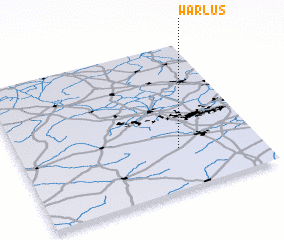 Places with similar names to Warlus, France ::
Disclaimer :: Information on this page comes without warranty of any kind |
||
|
Where is Warlus? Elevation and coordinates ::
Latitude (lat): 50°17'0"N Longitude (lon): 2°40'0"E
Elevation (approx.): 99m (map arrows pan, magnifying glasses zoom) |
||
|
Visiting Warlus? Hotel/Accommodation ::
Book a hotel in Warlus Travel Guide ::
Buy a travel guide for France rental cars ::
car rental offers GPS waypoint ::
download a GPX waypoint (PoI) of Warlus for your GPS receiver
|
||