|
search place name
|
||
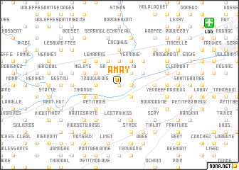
Amay (Liège, Belgium)Amay is a town in the Liège region of Belgium. An overview map of the region around Amay is displayed below.
regional and 3d topo map of Amay, Belgium ::
Amay airports ::
The nearest airport is LGG - Liege, located 13.2 km north east of Amay.
Other airports nearby include MST - Maastricht (51.4 km north east), CRL - Charleroi Brussels South (62.0 km west), GKE - Geilenkirchen (68.6 km north east), BRU - Brussels Natl (Melsbroek) (70.6 km north west), Nearby towns ::
Thier Pirka (0.0km north) //
Ombret-Rawsa (1.2km east) //
Haute Flône (1.2km east) //
Les Baraques (1.9km north) //
Richemont (1.9km north) //
Saule Gaillard (1.9km north) //
Ponthière (2.2km south east) //
Aux Forges (2.2km south east) //
Flône (2.2km north east) //
Sart Wesmael (2.2km north west) //
Rogerée (3.7km north) //
Jehay-Bodegnée (3.7km north) //
Bende (2.4km west) //
Trou du Bois (2.4km west) //
Yernawe (3.9km north) //
La Mallieue (3.0km north east) //
Bodegnée (3.9km north) //
Dieu le Garde (3.9km north) //
Taverne à Meuse (3.0km south west) //
Ampsin (3.0km south west) //
Neuville-sous-Huy (3.0km south west) //
Cabendes (3.0km north west) //
Barbotte (3.0km north west) //
Stockay (4.4km north east) //
Petit Bois (4.4km south west) //
Chalet (4.4km north west) //
Fize-Fontaine (4.4km north west) //
Le Marais (4.4km north west) //
Les Trixhes (5.6km south) //
[all distances 'as the bird flies' and approximate] 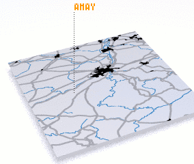 Places with similar names to Amay, Belgium ::
Disclaimer :: Information on this page comes without warranty of any kind |
||
|
Where is Amay? Elevation and coordinates ::
Latitude (lat): 50°33'0"N Longitude (lon): 5°19'0"E
Elevation (approx.): 100m (map arrows pan, magnifying glasses zoom) |
||
|
Visiting Amay? Hotel/Accommodation ::
Book a hotel in Amay Travel Guide ::
Buy a travel guide for Belgium rental cars ::
car rental offers GPS waypoint ::
download a GPX waypoint (PoI) of Amay for your GPS receiver
|
||