|
search place name
|
||
Aspelare (Oost-Vlaanderen, Belgium)Aspelare is a town in the Oost-Vlaanderen region of Belgium. An overview map of the region around Aspelare is displayed below.
regional and 3d topo map of Aspelare, Belgium ::

Aspelare airports ::
The nearest airport is BRU - Brussels Natl (Melsbroek), located 38.4 km east of Aspelare.
Other airports nearby include QKT - Kortrijk-vevelgem Wevelgem (52.5 km west), ANR - Antwerp Deurne (53.4 km north east), CRL - Charleroi Brussels South (54.8 km south east), LIL - Lille Lesquin (67.9 km south west), Nearby towns ::
Half (0.0km north) //
Appelterre-Eichem (1.9km south) //
Zevenhoek (1.9km south) //
Voorde (1.9km south) //
Broodhoek (1.2km west) //
Muilem (1.2km east) //
Kabbeke (1.2km west) //
Oppem (1.2km west) //
Hegge (1.2km west) //
Biest (1.9km north) //
Roon (1.9km north) //
Wildendries (1.9km north) //
Terbert (1.9km north) //
Walhoven (1.9km north) //
Nederstraat (2.2km south east) //
Ettelboom (2.2km north west) //
Roeselare (2.2km north west) //
Destelberg (2.2km north west) //
Nederhasselt (2.2km north east) //
Slettem (2.2km north east) //
Zevenkoten (2.3km east) //
Outer (2.3km east) //
Molenhoek (2.3km east) //
Winkel (2.3km west) //
Bever (2.3km west) //
Broeken (3.7km south) //
Grimminge (3.7km south) //
Lust (3.7km south) //
Vogelenzang (3.7km north) //
[all distances 'as the bird flies' and approximate] 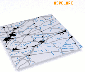 Places with similar names to Aspelare, Belgium :: Disclaimer :: Information on this page comes without warranty of any kind |
||
|
Where is Aspelare? Elevation and coordinates ::
Latitude (lat): 50°50'0"N Longitude (lon): 3°57'0"E
Elevation (approx.): 42m (map arrows pan, magnifying glasses zoom) |
||
|
Visiting Aspelare? Hotel/Accommodation ::
Book a hotel in Aspelare Travel Guide ::
Buy a travel guide for Belgium rental cars ::
car rental offers GPS waypoint ::
download a GPX waypoint (PoI) of Aspelare for your GPS receiver
|
||