|
search place name
|
||
Assebroek (West-Vlaanderen, Belgium)Assebroek is a town in the West-Vlaanderen region of Belgium. An overview map of the region around Assebroek is displayed below.
regional and 3d topo map of Assebroek, Belgium ::

Assebroek airports ::
The nearest airport is OST - Oostende, located 28.3 km west of Assebroek.
Other airports nearby include QKT - Kortrijk-vevelgem Wevelgem (42.8 km south), LIL - Lille Lesquin (72.1 km south), WOE - Woensdrecht (79.9 km east), ANR - Antwerp Deurne (83.4 km east), Nearby towns ::
Zevekote (1.2km west) //
Male (2.2km north east) //
Sint-Kruis (2.2km north west) //
Hekhoek (2.3km east) //
Moerbrugge (3.7km south) //
Oostzijde (3.7km south) //
Vliegendpaard (3.0km south east) //
Brugge (3.0km north west) //
Steenbrugge (3.0km south west) //
Wulgebroek (4.4km south west) //
Sijsele (3.5km east) //
Stuivenberg (5.6km south) //
Damme (5.7km north) //
Gevaarts (5.7km south) //
Koolkerke (5.7km north) //
Stakendijk (3.9km north east) //
Sijseleveld (3.9km north east) //
Berg (3.9km south east) //
Egypten (3.9km south east) //
Vijve Kapelle (5.1km north east) //
Sint-Katelijne (6.0km north east) //
Doorn (5.1km south east) //
Veldhoek (6.0km south east) //
Klinkewal (6.0km north west) //
Oostkamp (6.0km south west) //
Pereboom (7.4km north) //
Erkegem (7.4km south) //
Nachtegaal (7.4km south) //
Zwaan (5.0km east) //
[all distances 'as the bird flies' and approximate] 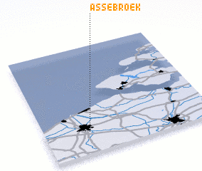 Places with similar names to Assebroek, Belgium ::
Disclaimer :: Information on this page comes without warranty of any kind |
||
|
Where is Assebroek? Elevation and coordinates ::
Latitude (lat): 51°12'0"N Longitude (lon): 3°16'0"E
Elevation (approx.): 4m (map arrows pan, magnifying glasses zoom) |
||
|
Visiting Assebroek? Hotel/Accommodation ::
Book a hotel in Assebroek Travel Guide ::
Buy a travel guide for Belgium rental cars ::
car rental offers GPS waypoint ::
download a GPX waypoint (PoI) of Assebroek for your GPS receiver
|
||