|
search place name
|
||
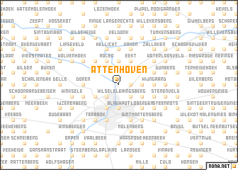
Attenhoven (Brabant, Belgium)Attenhoven is a town in the Brabant region of Belgium. An overview map of the region around Attenhoven is displayed below.
regional and 3d topo map of Attenhoven, Belgium ::
Attenhoven airports ::
The nearest airport is BRU - Brussels Natl (Melsbroek), located 16.4 km west of Attenhoven.
Other airports nearby include ANR - Antwerp Deurne (35.3 km north west), CRL - Charleroi Brussels South (54.2 km south), LGG - Liege (59.9 km south east), WOE - Woensdrecht (64.8 km north west), Nearby towns ::
Langveld (1.2km east) //
Putkapel (1.9km north) //
Drie Linden (1.9km north) //
Kwadenhoek (2.2km north east) //
Wijgmaal (2.2km north west) //
Beneden Kessel (2.2km south east) //
Lemingsberg (2.2km south east) //
Wilsele (2.2km south west) //
Meesberg (2.3km east) //
Holsbeek (2.3km east) //
Rotselaar (3.7km north) //
Blauwput (3.7km south) //
Beversluis (3.9km north) //
Eekt (3.9km north) //
Kessel-Lo (3.0km south east) //
Goot (3.9km north) //
Achterheide (3.9km north) //
Molen (3.9km north) //
Kareelveld (3.0km south west) //
Leuven (3.9km south) //
Walestraat (4.4km north west) //
Wakkerzeel (4.4km north west) //
Kelfs (4.4km north west) //
Lo (4.4km south east) //
Lobergen (4.4km south east) //
Hoogland (5.6km north) //
Wijngaard (3.5km east) //
Doren (3.5km west) //
Predikherenberg (5.7km south) //
[all distances 'as the bird flies' and approximate]  Places with similar names to Attenhoven, Belgium ::
// Attenhöfen (DE)
// Attenhofen (DE)
// Attenhofen (DE)
// Attenhofen (DE)
// Attenhoven (BE)
// Attenhofen (DE)
Disclaimer :: Information on this page comes without warranty of any kind |
||
|
Where is Attenhoven? Elevation and coordinates ::
Latitude (lat): 50°55'0"N Longitude (lon): 4°43'0"E
Elevation (approx.): 14m (map arrows pan, magnifying glasses zoom) |
||
|
Visiting Attenhoven? Hotel/Accommodation ::
Book a hotel in Attenhoven Travel Guide ::
Buy a travel guide for Belgium rental cars ::
car rental offers GPS waypoint ::
download a GPX waypoint (PoI) of Attenhoven for your GPS receiver
|
||