|
search place name
|
||
Bassenge (Liège, Belgium)Bassenge is a town in the Liège region of Belgium. An overview map of the region around Bassenge is displayed below.
regional and 3d topo map of Bassenge, Belgium ::

Bassenge airports ::
The nearest airport is LGG - Liege, located 18.1 km south west of Bassenge.
Other airports nearby include MST - Maastricht (20.1 km north east), GKE - Geilenkirchen (37.9 km north east), EIN - Eindhoven (77.7 km north), BRU - Brussels Natl (Melsbroek) (80.0 km west), Nearby towns ::
Once (1.2km west) //
Boirs (1.9km south) //
Roclenge-sur-Geer (1.9km south) //
Zichen-Zussen-Bolder (2.2km north east) //
Val-Meer (2.2km north west) //
Bolder (3.7km north) //
Riemst (3.7km north) //
Neuville (2.3km west) //
Wonck (2.3km east) //
Romont (3.0km north east) //
Meer (3.9km north) //
Meerberg (3.9km north) //
Heukelom (3.9km north) //
Bas Slins (3.0km south west) //
Froidmont (3.0km south east) //
Pierreux (3.0km south east) //
Houtain-Saint-Siméon (3.9km south) //
Zussen (4.4km north east) //
Slins (4.4km south west) //
Amry (4.4km south east) //
Heure-le-Romain (4.4km south east) //
Elst (3.5km west) //
Tilice (5.6km south) //
Millen (4.0km north west) //
Siberg (5.7km north) //
Laaffelterberg (5.7km north) //
Hermée (5.7km south) //
Grand Aaz (5.7km south) //
Broux (5.7km south) //
[all distances 'as the bird flies' and approximate] 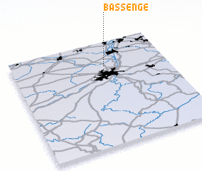 Places with similar names to Bassenge, Belgium ::
Disclaimer :: Information on this page comes without warranty of any kind |
||
|
Where is Bassenge? Elevation and coordinates ::
Latitude (lat): 50°46'0"N Longitude (lon): 5°36'0"E
Elevation (approx.): 119m (map arrows pan, magnifying glasses zoom) |
||
|
Visiting Bassenge? Hotel/Accommodation ::
Book a hotel in Bassenge Travel Guide ::
Buy a travel guide for Belgium rental cars ::
car rental offers GPS waypoint ::
download a GPX waypoint (PoI) of Bassenge for your GPS receiver
|
||