|
search place name
|
||
Biercamp (Hainaut, Belgium)Biercamp is a town in the Hainaut region of Belgium. An overview map of the region around Biercamp is displayed below.
regional and 3d topo map of Biercamp, Belgium ::

Biercamp airports ::
The nearest airport is QKT - Kortrijk-vevelgem Wevelgem, located 43.0 km west of Biercamp.
Other airports nearby include BRU - Brussels Natl (Melsbroek) (51.7 km east), LIL - Lille Lesquin (53.8 km west), CRL - Charleroi Brussels South (55.4 km south east), ANR - Antwerp Deurne (68.7 km north east), Nearby towns ::
Stoquoi (0.0km north) //
Solbreucq (0.0km north) //
Laisette (0.0km north) //
Ghoy (1.9km south) //
Petite Hollande (1.2km east) //
Quatre Vents (1.2km east) //
Ombreucq (1.2km west) //
Longpont (1.2km east) //
Marais (1.2km east) //
La Livarde (1.2km west) //
Ginintreau (1.2km west) //
Spinele (1.9km north) //
Cloître (1.9km north) //
Houtaing (2.2km south east) //
La Blanche (2.2km south west) //
Haute Rue (2.2km south west) //
Wardois (2.2km south west) //
Kenimont (2.2km south east) //
Mon Passage (2.2km north east) //
Zarlardinge (2.2km north east) //
Reke (2.2km north east) //
Hemelrijk (2.2km north west) //
Terraque (3.7km south) //
Wannebecq (3.7km south) //
Sottenière (2.3km west) //
Bichourée (2.3km west) //
Aubecq (2.3km west) //
Le Ponchau (2.3km west) //
Planque (2.3km west) //
[all distances 'as the bird flies' and approximate] 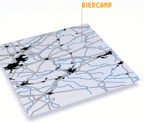 Places with similar names to Biercamp, Belgium ::
// Burkamp (DE)
Disclaimer :: Information on this page comes without warranty of any kind |
||
|
Where is Biercamp? Elevation and coordinates ::
Latitude (lat): 50°44'0"N Longitude (lon): 3°48'0"E
Elevation (approx.): 38m (map arrows pan, magnifying glasses zoom) |
||
|
Visiting Biercamp? Hotel/Accommodation ::
Book a hotel in Biercamp Travel Guide ::
Buy a travel guide for Belgium rental cars ::
car rental offers GPS waypoint ::
download a GPX waypoint (PoI) of Biercamp for your GPS receiver
|
||