|
search place name
|
||
Blauwenhoek (Brabant, Belgium)Blauwenhoek is a town in the Brabant region of Belgium. An overview map of the region around Blauwenhoek is displayed below.
regional and 3d topo map of Blauwenhoek, Belgium ::

Blauwenhoek airports ::
The nearest airport is BRU - Brussels Natl (Melsbroek), located 18.2 km south east of Blauwenhoek.
Other airports nearby include ANR - Antwerp Deurne (22.3 km north east), WOE - Woensdrecht (48.2 km north), CRL - Charleroi Brussels South (63.0 km south), QKT - Kortrijk-vevelgem Wevelgem (80.2 km west), Nearby towns ::
Ursene (0.0km north) //
Sint-Jozef (1.9km north) //
Heide (1.9km north) //
Neerhavert (1.9km north) //
Stuikberg (1.9km north) //
Koestaart (1.9km north) //
Groteheide (1.9km north) //
Moorhoek (1.2km west) //
Meerstraat (1.2km east) //
Londerzeel (1.9km south) //
Houtekruis (2.2km north west) //
Veurt (2.2km north east) //
Pluimennest (2.2km south west) //
Linde (2.2km south west) //
De Wolf (3.7km north) //
Stampershoek (3.7km north) //
Letterheide (3.7km north) //
Hogeheide (3.7km north) //
Weverstraat (2.3km east) //
Beekstraat (2.3km west) //
Hagelboom (2.3km east) //
Molenhoek (2.3km east) //
Sneppelaar (2.3km west) //
Ramsdonk (2.3km east) //
Slozen (3.7km south) //
Kasteelheide (3.0km north west) //
Schaafstraat (3.9km north) //
Ruitersdries (3.9km north) //
Moerheide (3.9km north) //
[all distances 'as the bird flies' and approximate] 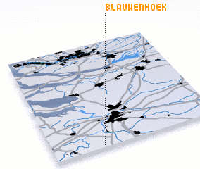 Places with similar names to Blauwenhoek, Belgium ::
Disclaimer :: Information on this page comes without warranty of any kind |
||
|
Where is Blauwenhoek? Elevation and coordinates ::
Latitude (lat): 51°1'0"N Longitude (lon): 4°18'0"E
Elevation (approx.): 9m (map arrows pan, magnifying glasses zoom) |
||
|
Visiting Blauwenhoek? Hotel/Accommodation ::
Book a hotel in Blauwenhoek Travel Guide ::
Buy a travel guide for Belgium rental cars ::
car rental offers GPS waypoint ::
download a GPX waypoint (PoI) of Blauwenhoek for your GPS receiver
|
||