|
search place name
|
||
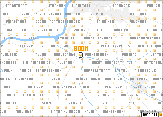
Boom (Antwerpen, Belgium)Boom is a town in the Antwerpen region of Belgium. An overview map of the region around Boom is displayed below.
regional and 3d topo map of Boom, Belgium ::
Boom airports ::
The nearest airport is ANR - Antwerp Deurne, located 13.5 km north east of Boom.
Other airports nearby include BRU - Brussels Natl (Melsbroek) (21.9 km south), WOE - Woensdrecht (40.7 km north), CRL - Charleroi Brussels South (69.7 km south), EIN - Eindhoven (81.3 km north east), Nearby towns ::
Klein Willebroek (0.0km north) //
Schomme (1.2km east) //
Willebroek (1.9km south) //
Kaasstraat (1.9km south) //
Krekelenberg (1.9km north) //
De Raaf (1.9km north) //
Vorsenpoel (2.2km south west) //
Molenstraat (2.2km north east) //
Vlietmanshoek (2.2km north east) //
Noeveren (2.2km north west) //
Walenhoek (2.2km north west) //
Bossen (2.2km north west) //
Dubbelhof (2.2km north west) //
Voskenshoek (2.3km east) //
Bosstraat (2.3km east) //
Terhagen (2.3km east) //
Blaasveld (3.7km south) //
Sauvegarde (2.3km west) //
Ruisbroek (2.3km west) //
Moerhoek (2.3km west) //
Turkijen (3.7km north) //
Hamerdijk (3.0km south east) //
Bocht (3.0km south east) //
Grote Bergen (3.0km south east) //
Heindonk (3.0km south east) //
Grote Heide (3.9km south) //
Clemenshoek (3.0km north east) //
Pullaar (3.0km south west) //
Vaart (3.9km north) //
[all distances 'as the bird flies' and approximate] 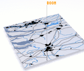 Places with similar names to Boom, Belgium ::
Disclaimer :: Information on this page comes without warranty of any kind |
||
|
Where is Boom? Elevation and coordinates ::
Latitude (lat): 51°5'0"N Longitude (lon): 4°22'0"E
Elevation (approx.): 1m (map arrows pan, magnifying glasses zoom) |
||
|
Visiting Boom? Hotel/Accommodation ::
Book a hotel in Boom Travel Guide ::
Buy a travel guide for Belgium rental cars ::
car rental offers GPS waypoint ::
download a GPX waypoint (PoI) of Boom for your GPS receiver
|
||