|
search place name
|
||
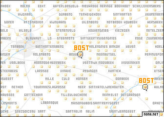
Bost (Brabant, Belgium)Bost is a town in the Brabant region of Belgium. An overview map of the region around Bost is displayed below.
regional and 3d topo map of Bost, Belgium ::
Bost airports ::
The nearest airport is BRU - Brussels Natl (Melsbroek), located 24.1 km west of Bost.
Other airports nearby include ANR - Antwerp Deurne (45.3 km north west), LGG - Liege (50.2 km south east), CRL - Charleroi Brussels South (50.5 km south west), MST - Maastricht (67.5 km east), Nearby towns ::
Butsel (1.2km east) //
Boutersem (1.2km east) //
Bruul (1.2km west) //
Herendaal (1.9km north) //
Drogenhof (1.9km north) //
Uilekot (1.9km north) //
Sint-Martensberg (2.2km north east) //
Heideken (2.2km north east) //
Rozemarijn (2.2km north east) //
Vertrijk (2.2km south east) //
Pellenberg (2.2km north west) //
Benedenheide (2.2km south west) //
Lat (2.2km north west) //
Bollenberg (3.7km north) //
Ledigheid (3.7km north) //
Hoogbutsel (2.3km east) //
Neervelp (3.7km south) //
Brempt (2.3km west) //
Lovenjoel (2.3km west) //
Lubbeek (3.9km north) //
Willebringen (3.9km south) //
Redingen (3.9km south) //
De Plein (3.9km north) //
Brakum (3.0km north east) //
Malendries (3.0km north east) //
Molensteen (3.9km south) //
Opvelp (3.9km south) //
Bovenheide (3.0km south west) //
Sint-Geertruidendries (4.4km north east) //
[all distances 'as the bird flies' and approximate] 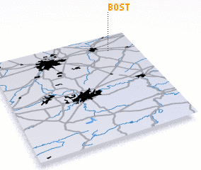 Places with similar names to Bost, Belgium ::
Disclaimer :: Information on this page comes without warranty of any kind |
||
|
Where is Bost? Elevation and coordinates ::
Latitude (lat): 50°51'0"N Longitude (lon): 4°49'0"E
Elevation (approx.): 68m (map arrows pan, magnifying glasses zoom) |
||
|
Visiting Bost? Hotel/Accommodation ::
Book a hotel in Bost Travel Guide ::
Buy a travel guide for Belgium rental cars ::
car rental offers GPS waypoint ::
download a GPX waypoint (PoI) of Bost for your GPS receiver
|
||