|
search place name
|
||
Braffe (Hainaut, Belgium)Braffe is a town in the Hainaut region of Belgium. An overview map of the region around Braffe is displayed below.
regional and 3d topo map of Braffe, Belgium ::

Braffe airports ::
The nearest airport is LIL - Lille Lesquin, located 33.8 km west of Braffe.
Other airports nearby include QKT - Kortrijk-vevelgem Wevelgem (39.2 km north west), CRL - Charleroi Brussels South (63.7 km east), BRU - Brussels Natl (Melsbroek) (75.7 km north east), OST - Oostende (87.6 km north west), Nearby towns ::
Quesnoy (0.0km north) //
Baugnies (1.2km west) //
Ghyssegnies (1.9km north) //
Ponange (1.9km north) //
Roucourt (2.2km south east) //
Bitremont (2.2km south east) //
Bocarmé (2.2km south east) //
Bury (2.2km south east) //
Brasmenil (2.2km south west) //
Lignette (2.2km north west) //
Barisoeul (3.7km north) //
Wasmes (2.4km west) //
Briffoeil (2.4km west) //
Buissière (3.9km south) //
Péruwelz (3.9km south) //
La Dîme (3.9km north) //
La Planche (3.9km north) //
Grosmont (3.9km south) //
Verquesies (3.9km south) //
Willaupuis (3.0km north east) //
Caumont (3.9km north) //
Weyaux (3.0km north west) //
La Cavée (3.0km north west) //
La Boiterie (4.4km south east) //
Outre lʼEau (4.4km south east) //
Vieux Leuze (4.4km north east) //
Barry (4.4km north west) //
Cerfontaine (5.6km south) //
Gallaix (5.6km north) //
[all distances 'as the bird flies' and approximate] 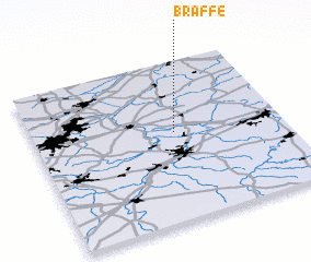 Places with similar names to Braffe, Belgium ::
Disclaimer :: Information on this page comes without warranty of any kind |
||
|
Where is Braffe? Elevation and coordinates ::
Latitude (lat): 50°33'0"N Longitude (lon): 3°34'0"E
Elevation (approx.): 43m (map arrows pan, magnifying glasses zoom) |
||
|
Visiting Braffe? Hotel/Accommodation ::
Book a hotel in Braffe Travel Guide ::
Buy a travel guide for Belgium rental cars ::
car rental offers GPS waypoint ::
download a GPX waypoint (PoI) of Braffe for your GPS receiver
|
||