|
search place name
|
||
Brandheide (Antwerpen, Belgium)Brandheide is a town in the Antwerpen region of Belgium. An overview map of the region around Brandheide is displayed below.
regional and 3d topo map of Brandheide, Belgium ::

Brandheide airports ::
The nearest airport is BRU - Brussels Natl (Melsbroek), located 16.8 km south west of Brandheide.
Other airports nearby include ANR - Antwerp Deurne (19.9 km north west), WOE - Woensdrecht (49.6 km north), CRL - Charleroi Brussels South (64.7 km south), EIN - Eindhoven (71.2 km north east), Nearby towns ::
De Merkt (0.0km north) //
Watermolenhoek (1.9km south) //
ʼt Kruispunt (1.9km south) //
Kraai Venne (1.9km south) //
Wuines (1.2km east) //
Magerenkool (1.2km east) //
Ottershoek (1.2km east) //
Harent (1.2km west) //
Koolhof (1.2km east) //
Peulis (1.2km west) //
Spikkelenberg (2.2km north east) //
Iksenheuvel (2.2km north east) //
Kalverheide (2.3km east) //
Zeept (3.7km south) //
Doornlaar (3.0km south east) //
Keerbergen (3.9km south) //
Boterhoek (3.9km north) //
Stenenmolen (3.9km north) //
Zoeteweide (3.9km north) //
Rijmenam (4.4km south west) //
Vossekot (4.4km south east) //
Onze-Lieve-Vrouw-Waver (4.4km north west) //
Putte (4.4km north east) //
Oudenmolen (4.4km north east) //
Groten Brand (5.6km north) //
Diedonken (3.5km west) //
Berentrode (3.5km west) //
Grasheide (3.5km east) //
Leemput (5.6km south) //
[all distances 'as the bird flies' and approximate] 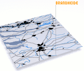 Places with similar names to Brandheide, Belgium ::
// Brandheide (DE)
// Brandheide (DE)
Disclaimer :: Information on this page comes without warranty of any kind |
||
|
Where is Brandheide? Elevation and coordinates ::
Latitude (lat): 51°2'0"N Longitude (lon): 4°36'0"E
Elevation (approx.): 6m (map arrows pan, magnifying glasses zoom) |
||
|
Visiting Brandheide? Hotel/Accommodation ::
Book a hotel in Brandheide Travel Guide ::
Buy a travel guide for Belgium rental cars ::
car rental offers GPS waypoint ::
download a GPX waypoint (PoI) of Brandheide for your GPS receiver
|
||