|
search place name
|
||
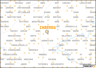
Charneu (Namur, Belgium)Charneu is a town in the Namur region of Belgium. An overview map of the region around Charneu is displayed below.
regional and 3d topo map of Charneu, Belgium ::
Charneu airports ::
The nearest airport is LGG - Liege, located 30.6 km north of Charneu.
Other airports nearby include CRL - Charleroi Brussels South (65.7 km west), MST - Maastricht (67.0 km north east), GKE - Geilenkirchen (81.6 km north east), BRU - Brussels Natl (Melsbroek) (86.2 km north west), Nearby towns ::
Bonsin (0.0km north) //
Bassines (1.2km west) //
Hergersberg (1.9km south) //
Vervox (3.7km north) //
Méan (2.4km west) //
Somme-Leuze (3.7km south) //
Borlon (3.0km north east) //
Fagny (3.0km north east) //
Petite Somme (3.0km south east) //
Gros Chêne (3.0km south west) //
Amas (4.4km north east) //
Ocquier (4.4km north east) //
Bois-et-Borsu (4.4km north west) //
Chêne à Han (4.4km south east) //
Leuze (4.4km south west) //
Clavier (5.6km north) //
Atrin (5.6km north) //
Borsu (4.0km north west) //
Petite Éneille (5.7km south) //
Grande Eneille (5.7km south) //
Maffe (4.0km south west) //
Septon (4.0km south east) //
Ponthoz (6.0km north east) //
Monteuville (6.0km south east) //
Petit Brin (6.0km north west) //
Les Aloux (5.1km south west) //
Somal (5.1km south west) //
Grandhan (5.1km south east) //
Ochain (7.4km north) //
[all distances 'as the bird flies' and approximate] 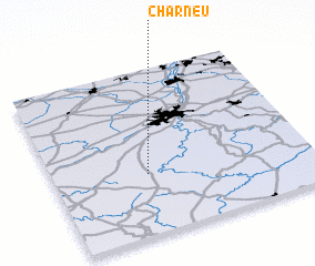 Places with similar names to Charneu, Belgium ::
Disclaimer :: Information on this page comes without warranty of any kind |
||
|
Where is Charneu? Elevation and coordinates ::
Latitude (lat): 50°22'0"N Longitude (lon): 5°22'0"E
Elevation (approx.): 293m (map arrows pan, magnifying glasses zoom) |
||
|
Visiting Charneu? Hotel/Accommodation ::
Book a hotel in Charneu Travel Guide ::
Buy a travel guide for Belgium rental cars ::
car rental offers GPS waypoint ::
download a GPX waypoint (PoI) of Charneu for your GPS receiver
|
||