|
search place name
|
||
Coignelet (Luxembourg, Belgium)Coignelet is a town in the Luxembourg region of Belgium. An overview map of the region around Coignelet is displayed below.
regional and 3d topo map of Coignelet, Belgium ::

Coignelet airports ::
The nearest airport is LGG - Liege, located 39.5 km north west of Coignelet.
Other airports nearby include MST - Maastricht (66.5 km north), GKE - Geilenkirchen (76.0 km north), SPM - Spangdahlem Ab (81.7 km south east), LUX - Luxemburg Luxembourg (85.6 km south east), Nearby towns ::
Trou Renard (0.0km north) //
Bien du Censier (1.2km west) //
La Fourche (1.9km north) //
Hatoufat (1.9km north) //
Hasal (1.2km east) //
Derrière le Chêne (1.9km south) //
Pont Gérard (2.2km north west) //
Chêne al Pierre (2.2km north west) //
La Gottale (2.2km north east) //
Grande Fonderie (2.2km south west) //
Manhay (2.2km south west) //
Vaux-Chavanne (2.2km south east) //
Mont Derrieux (2.4km west) //
Hache (2.4km west) //
Fond de la Justice (3.7km south) //
Croukray (2.4km east) //
Monchenoul (3.9km north) //
Brunayet (3.9km south) //
Grand Gotta (3.9km south) //
Xhout-si-Plout (3.0km south east) //
La Satte (3.0km south east) //
Harre (4.4km north west) //
Grandmenil (4.4km south west) //
Malempré (4.4km south east) //
Odeigne (5.6km south) //
Bra (3.6km east) //
Taille Martin (5.6km north) //
La Grosse Haie (5.7km south) //
Petite Hoursinne (4.0km north west) //
[all distances 'as the bird flies' and approximate] 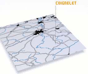 Places with similar names to Coignelet, Belgium ::
// Cagnoletti (IT)
Disclaimer :: Information on this page comes without warranty of any kind |
||
|
Where is Coignelet? Elevation and coordinates ::
Latitude (lat): 50°19'0"N Longitude (lon): 5°41'0"E
Elevation (approx.): 461m (map arrows pan, magnifying glasses zoom) |
||
|
Visiting Coignelet? Hotel/Accommodation ::
Book a hotel in Coignelet Travel Guide ::
Buy a travel guide for Belgium rental cars ::
car rental offers GPS waypoint ::
download a GPX waypoint (PoI) of Coignelet for your GPS receiver
|
||