|
search place name
|
||
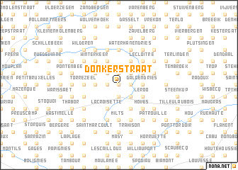
Donkerstraat (Hainaut, Belgium)Donkerstraat is a town in the Hainaut region of Belgium. An overview map of the region around Donkerstraat is displayed below.
regional and 3d topo map of Donkerstraat, Belgium ::
Donkerstraat airports ::
The nearest airport is BRU - Brussels Natl (Melsbroek), located 40.8 km north east of Donkerstraat.
Other airports nearby include CRL - Charleroi Brussels South (41.8 km south east), QKT - Kortrijk-vevelgem Wevelgem (57.6 km west), ANR - Antwerp Deurne (63.3 km north east), LIL - Lille Lesquin (66.2 km west), Nearby towns ::
Torreborre (0.0km north) //
Kwatem (1.9km north) //
Hellingen (1.9km north) //
Smeyers Marcq (1.2km east) //
Sint-Pieters-Kapelle (1.2km west) //
Rasbeek (1.2km west) //
Candries (1.9km south) //
Rendries (2.2km north east) //
Hand Kerselare (2.2km north west) //
Cortenbroek (2.2km south east) //
Mark (2.2km south east) //
Marcq (2.2km south east) //
Galgendries (2.3km east) //
Manhaag (2.3km west) //
Enghien (2.3km east) //
Muilebeek (3.9km north) //
Stevelberg (3.9km north) //
Hazendries (3.9km north) //
Tollembeek (3.9km north) //
Dronkaard (3.9km north) //
Heisbroek (3.0km north west) //
Herne (3.0km north east) //
Le Roo (3.0km south east) //
Labliau (3.9km south) //
Humbeek (3.9km south) //
La Croisette (3.9km south) //
Winterkeer (4.4km north west) //
Le Cloître (4.4km north east) //
Himbeek (4.4km north east) //
[all distances 'as the bird flies' and approximate]  Places with similar names to Donkerstraat, Belgium ::
// Donkerstraat (BE)
Disclaimer :: Information on this page comes without warranty of any kind |
||
|
Where is Donkerstraat? Elevation and coordinates ::
Latitude (lat): 50°42'0"N Longitude (lon): 4°0'0"E
Elevation (approx.): 50m (map arrows pan, magnifying glasses zoom) |
||
|
Visiting Donkerstraat? Hotel/Accommodation ::
Book a hotel in Donkerstraat Travel Guide ::
Buy a travel guide for Belgium rental cars ::
car rental offers GPS waypoint ::
download a GPX waypoint (PoI) of Donkerstraat for your GPS receiver
|
||