|
search place name
|
||
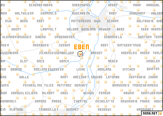
Eben (Limburg, Belgium)Eben is a town in the Limburg region of Belgium. An overview map of the region around Eben is displayed below.
regional and 3d topo map of Eben, Belgium ::
nearby GPS traces from timatio ::
Eben airports ::
The nearest airport is MST - Maastricht, located 16.0 km north east of Eben.
Other airports nearby include LGG - Liege (22.6 km south west), GKE - Geilenkirchen (33.0 km north east), EIN - Eindhoven (77.0 km north), MGL - Moenchengladbach Monchengladbach (77.0 km north east), Nearby towns ::
Lava (0.0km north) //
Lanaye (1.2km east) //
Loën (1.9km south) //
Eben-Emael (1.9km north) //
Navagne (2.2km south east) //
Nivelle (2.2km south east) //
Petit-Lanaye (2.2km north east) //
Eijsden (2.3km east) //
Breust (2.3km east) //
Lixhe (3.7km south) //
Kanne (3.7km north) //
Neerkanne (3.7km north) //
Maasmechelen (3.7km north) //
Romont (2.3km west) //
Laag-Caestert (3.0km south east) //
Hoog-Caestert (3.0km south east) //
Wonck (3.0km south west) //
Zussen (3.0km north west) //
Froidmont (4.4km south west) //
Pierreux (4.4km south west) //
Vroenhoven (4.4km north west) //
Mariadorp (3.5km east) //
Zichen-Zussen-Bolder (3.5km west) //
Haccourt (5.6km south) //
Hallembaye (5.6km south) //
Biesland (5.7km north) //
Withuis (4.0km south east) //
Devant le Pont (5.7km south) //
Basse Hermalle (5.7km south) //
[all distances 'as the bird flies' and approximate] 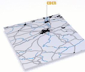 Places with similar names to Eben, Belgium ::
Disclaimer :: Information on this page comes without warranty of any kind |
||
|
Where is Eben? Elevation and coordinates ::
Latitude (lat): 50°47'0"N Longitude (lon): 5°40'0"E
Elevation (approx.): 81m (map arrows pan, magnifying glasses zoom) |
||
|
Visiting Eben? Hotel/Accommodation ::
Book a hotel in Eben Travel Guide ::
Buy a travel guide for Belgium rental cars ::
car rental offers GPS waypoint ::
download a GPX waypoint (PoI) of Eben for your GPS receiver
|
||