|
search place name
|
||
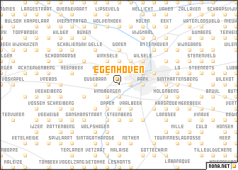
Egenhoven (Brabant, Belgium)Egenhoven is a town in the Brabant region of Belgium. An overview map of the region around Egenhoven is displayed below.
regional and 3d topo map of Egenhoven, Belgium ::
Egenhoven airports ::
The nearest airport is BRU - Brussels Natl (Melsbroek), located 13.4 km west of Egenhoven.
Other airports nearby include ANR - Antwerp Deurne (38.7 km north), CRL - Charleroi Brussels South (47.8 km south), LGG - Liege (60.4 km south east), WOE - Woensdrecht (68.7 km north), Nearby towns ::
Terbank (1.2km east) //
Rotspoel (1.9km south) //
IJzerenberg (2.2km north west) //
Windbergen (2.2km south west) //
Korbeek-Dijle (2.2km south west) //
Herent (3.7km north) //
Heverlee (2.3km east) //
Park (2.3km east) //
Oude Baan (2.3km west) //
Bertem (2.3km west) //
Oud-Heverlee (3.7km south) //
Kareelveld (3.9km north) //
Leuven (3.0km north east) //
Winksele (3.9km north) //
Bovenberg (3.0km north west) //
Bertembos (3.0km north west) //
Vaalbeek (3.9km south) //
Oppem (3.9km south) //
Wilsele (4.4km north east) //
Langerode (4.4km south west) //
Doren (5.6km north) //
Steenberg (5.6km south) //
Blauwput (4.0km north east) //
Prage (5.7km south) //
Sint-Verone (4.0km south west) //
Heide (5.7km south) //
Beisem (5.1km north west) //
Veltem-Beisem (5.1km north west) //
La Plaine (6.0km south east) //
[all distances 'as the bird flies' and approximate] 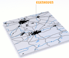
Disclaimer :: Information on this page comes without warranty of any kind |
||
|
Where is Egenhoven? Elevation and coordinates ::
Latitude (lat): 50°52'0"N Longitude (lon): 4°40'0"E
Elevation (approx.): 36m (map arrows pan, magnifying glasses zoom) |
||
|
Visiting Egenhoven? Hotel/Accommodation ::
Book a hotel in Egenhoven Travel Guide ::
Buy a travel guide for Belgium rental cars ::
car rental offers GPS waypoint ::
download a GPX waypoint (PoI) of Egenhoven for your GPS receiver
|
||