|
search place name
|
||
Eiliboshoek (Antwerpen, Belgium)Eiliboshoek is a town in the Antwerpen region of Belgium. An overview map of the region around Eiliboshoek is displayed below.
regional and 3d topo map of Eiliboshoek, Belgium ::

Eiliboshoek airports ::
The nearest airport is ANR - Antwerp Deurne, located 10.0 km north of Eiliboshoek.
Other airports nearby include BRU - Brussels Natl (Melsbroek) (22.1 km south), WOE - Woensdrecht (39.8 km north), CRL - Charleroi Brussels South (71.3 km south), EIN - Eindhoven (74.4 km north east), Nearby towns ::
Keizerenberg (0.0km north) //
Parwijs (1.2km east) //
Slekkehoeve (1.2km west) //
Waarloos (1.2km west) //
Vosberg (1.9km south) //
Duffelsenhoek (1.9km north) //
Kruisweg (2.2km south east) //
Lazarushoek (2.2km south west) //
Driehoek (3.7km north) //
De Beunt (2.3km east) //
Rechtestraat (2.3km east) //
Walem (3.7km south) //
Terbeek (2.3km west) //
Morenhoek (2.3km west) //
Beekhoek (3.9km north) //
Elzestraat (3.9km south) //
Kontich (3.9km north) //
Pompelaar (3.0km south east) //
Roetaardstraat (3.0km north east) //
Perwijsbroek (3.0km south east) //
Roetaardshoek (3.0km north east) //
Keizershoek (3.0km north west) //
Lint (4.4km north east) //
Gasthuishoeven (4.4km north east) //
Boonwit (4.4km north west) //
Sennegat (4.4km south west) //
Battenbroek (4.4km south west) //
Hove (5.6km north) //
Kleine Meil (5.6km north) //
[all distances 'as the bird flies' and approximate] 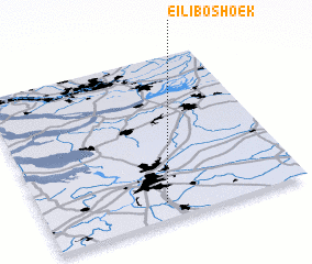 Places with similar names to Eiliboshoek, Belgium ::
Disclaimer :: Information on this page comes without warranty of any kind |
||
|
Where is Eiliboshoek? Elevation and coordinates ::
Latitude (lat): 51°6'0"N Longitude (lon): 4°28'0"E
Elevation (approx.): 17m (map arrows pan, magnifying glasses zoom) |
||
|
Visiting Eiliboshoek? Hotel/Accommodation ::
Book a hotel in Eiliboshoek Travel Guide ::
Buy a travel guide for Belgium rental cars ::
car rental offers GPS waypoint ::
download a GPX waypoint (PoI) of Eiliboshoek for your GPS receiver
|
||