|
search place name
|
||
El Hena (Liège, Belgium)El Hena is a town in the Liège region of Belgium. An overview map of the region around El Hena is displayed below.
regional and 3d topo map of El Hena, Belgium ::

El Hena airports ::
The nearest airport is LGG - Liege, located 23.9 km east of El Hena.
Other airports nearby include CRL - Charleroi Brussels South (49.0 km west), BRU - Brussels Natl (Melsbroek) (56.9 km north west), MST - Maastricht (58.8 km north east), GKE - Geilenkirchen (77.6 km north east), Nearby towns ::
Vissoul (0.0km north) //
Oteppe (1.2km east) //
Beaulette (1.9km south) //
Les Crenées (2.2km south east) //
Bolsée (2.2km south west) //
Boing (2.2km south west) //
Hebret (2.4km east) //
Buck (2.4km east) //
Marneffe (2.4km east) //
Lamontzée (2.4km west) //
Au Trou Sauvage (2.4km west) //
Ville-en-Hesbaye (3.7km north) //
Au Boland (3.7km north) //
Lavoir (3.9km south) //
Brivioule (3.9km north) //
Ciplet (3.9km north) //
Le Tombu (3.9km north) //
Héron (4.4km south west) //
Sur les Trixhes (5.6km south) //
Marsinne (5.6km south) //
Avennes (5.6km north) //
Burdinne (3.5km west) //
Les Trous (3.5km east) //
Envoz (5.7km south) //
Couthuin (5.7km south) //
Baegnée (5.7km north) //
Robiewez (4.0km south east) //
Bienonsart (4.0km south east) //
Huccorgne (4.0km south east) //
[all distances 'as the bird flies' and approximate] 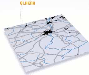 Places with similar names to El Hena, Belgium ::
Disclaimer :: Information on this page comes without warranty of any kind |
||
|
Where is El Hena? Elevation and coordinates ::
Latitude (lat): 50°35'0"N Longitude (lon): 5°7'0"E
Elevation (approx.): 158m (map arrows pan, magnifying glasses zoom) |
||
|
Visiting El Hena? Hotel/Accommodation ::
Book a hotel in El Hena Travel Guide ::
Buy a travel guide for Belgium rental cars ::
car rental offers GPS waypoint ::
download a GPX waypoint (PoI) of El Hena for your GPS receiver
|
||