|
search place name
|
||
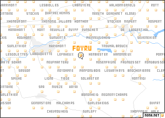
Foyru (Liège, Belgium)Foyru is a town in the Liège region of Belgium. An overview map of the region around Foyru is displayed below.
regional and 3d topo map of Foyru, Belgium ::
Foyru airports ::
The nearest airport is LGG - Liege, located 36.7 km west of Foyru.
Other airports nearby include MST - Maastricht (40.4 km north), GKE - Geilenkirchen (44.3 km north), MGL - Moenchengladbach Monchengladbach (83.5 km north east), SPM - Spangdahlem Ab (84.7 km south east), Nearby towns ::
Foyr (1.2km west) //
Jalhay (1.2km east) //
Charneux (1.9km south) //
Surister (2.2km south west) //
Le Faweux (2.4km west) //
Foxhalle (2.4km west) //
Herbiester (2.4km east) //
Hoboster (3.0km north east) //
Le Cossart (3.0km north west) //
Hèvremont (3.9km north) //
Goé (3.9km north) //
Pieresses (3.9km north) //
Gospinal (3.9km south) //
Parfond Bois (3.9km south) //
Croupet du Moulin (3.9km south) //
Pierreuse Heid (4.4km north east) //
Brand (4.4km north east) //
Perkiets (4.4km north east) //
Royompré (4.4km south west) //
Stembert (4.0km north west) //
Mariomont (4.0km north west) //
Sart (5.7km south) //
Solwaster (5.7km south) //
Mosenfagne (4.0km south east) //
Jehanster (4.0km south west) //
Neufmarteau (4.0km south west) //
LʼEwéréville (4.0km south west) //
Ruyff (5.7km north) //
Runschen (5.7km north) //
[all distances 'as the bird flies' and approximate] 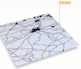 Places with similar names to Foyru, Belgium ::
Disclaimer :: Information on this page comes without warranty of any kind |
||
|
Where is Foyru? Elevation and coordinates ::
Latitude (lat): 50°34'0"N Longitude (lon): 5°57'0"E
Elevation (approx.): 347m (map arrows pan, magnifying glasses zoom) |
||
|
Visiting Foyru? Hotel/Accommodation ::
Book a hotel in Foyru Travel Guide ::
Buy a travel guide for Belgium rental cars ::
car rental offers GPS waypoint ::
download a GPX waypoint (PoI) of Foyru for your GPS receiver
|
||