|
search place name
|
||
Gramptinne (Namur, Belgium)Gramptinne is a town in the Namur region of Belgium. An overview map of the region around Gramptinne is displayed below.
regional and 3d topo map of Gramptinne, Belgium ::

Gramptinne airports ::
The nearest airport is LGG - Liege, located 37.3 km north east of Gramptinne.
Other airports nearby include CRL - Charleroi Brussels South (46.7 km west), BRU - Brussels Natl (Melsbroek) (72.2 km north west), MST - Maastricht (75.5 km north east), GKE - Geilenkirchen (92.5 km north east), Nearby towns ::
Maibe (1.9km south) //
Thion (1.9km south) //
Barrière de Champlon (1.2km west) //
Francesse (1.9km north) //
Wagnée (2.4km west) //
Frisée (2.4km east) //
Barsy (2.4km east) //
Wallay (3.7km north) //
Spase (3.7km north) //
Florée (3.0km south west) //
Schaltin (3.9km south) //
Champion (3.9km south) //
Maibelle (3.9km south) //
Houte (3.0km north west) //
Gesves (3.0km north west) //
Pourrain (3.0km north west) //
Sorée (3.0km north east) //
Fond de Gesves (3.9km north) //
Briansart (3.9km north) //
Francesse (4.4km south west) //
Pré de lʼOie (4.4km south west) //
Emblinne (5.6km south) //
Emeville (3.5km east) //
Bois dʼOhey (5.6km north) //
Skeuvre (5.7km south) //
Éve (4.0km north east) //
La Béole (4.0km north east) //
Sur le Try (5.7km north) //
Reppe (5.7km north) //
[all distances 'as the bird flies' and approximate] 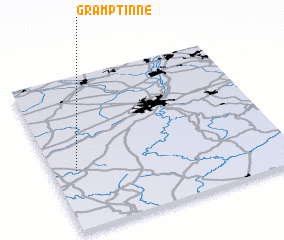 Places with similar names to Gramptinne, Belgium ::
// Crumptonia (US)
// Crîmpoteni (RO)
// Crampton (US)
// Crumpton (US)
// Crump Town (US)
// Crompton (US)
Disclaimer :: Information on this page comes without warranty of any kind |
||
|
Where is Gramptinne? Elevation and coordinates ::
Latitude (lat): 50°23'0"N Longitude (lon): 5°6'0"E
Elevation (approx.): 274m (map arrows pan, magnifying glasses zoom) |
||
|
Visiting Gramptinne? Hotel/Accommodation ::
Book a hotel in Gramptinne Travel Guide ::
Buy a travel guide for Belgium rental cars ::
car rental offers GPS waypoint ::
download a GPX waypoint (PoI) of Gramptinne for your GPS receiver
|
||