|
search place name
|
||
Grinvet (Luxembourg, Belgium)Grinvet is a town in the Luxembourg region of Belgium. An overview map of the region around Grinvet is displayed below.
regional and 3d topo map of Grinvet, Belgium ::

Grinvet airports ::
The nearest airport is LGG - Liege, located 59.3 km north of Grinvet.
Other airports nearby include LUX - Luxemburg Luxembourg (66.6 km south east), SPM - Spangdahlem Ab (72.1 km east), ZQF - Trier Fohren (82.5 km east), MST - Maastricht (86.7 km north), Nearby towns ::
Bonnerue (1.9km south) //
Rena Fontaine (1.2km west) //
Fagnoulle (1.2km west) //
Grande Mormont (1.9km north) //
Consy (2.2km south west) //
Engreux (2.2km south west) //
Filly (2.2km north west) //
Vellereux (3.7km south) //
Laid Thier (2.4km west) //
Wibrin (3.7km north) //
Mabompré (3.9km south) //
Choviompré (3.9km south) //
Achouffe (3.0km north east) //
Chevroumont (3.9km north) //
Ollomont (3.0km north west) //
Fonteni (4.4km north west) //
Nadrin (4.4km north west) //
Compogne (5.6km south) //
Hazy (3.6km east) //
Bodaimont (3.6km west) //
Sol Brouire (5.7km south) //
La Penne (4.0km south west) //
Hallet (4.0km south east) //
Les Chapons (5.7km north) //
Florka (5.7km south) //
Vivrou (5.7km south) //
Rastadt (5.7km south) //
Mont (4.0km north east) //
Vaux (6.0km south east) //
[all distances 'as the bird flies' and approximate] 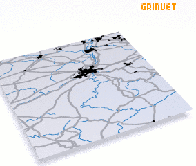 Places with similar names to Grinvet, Belgium ::
// Crnovoda (BA)
// Gornoviţa (RO)
// Gornoviţa (RO)
// Çarnuvat (TR)
// Garnavat (TJ)
// Cornivette (HT)
// Koorainghat (AU)
// Garnovit (AM)
// Kraunghta (MM)
// Krinófita (GR)
Disclaimer :: Information on this page comes without warranty of any kind |
||
|
Where is Grinvet? Elevation and coordinates ::
Latitude (lat): 50°8'0"N Longitude (lon): 5°43'0"E
Elevation (approx.): 388m (map arrows pan, magnifying glasses zoom) |
||
|
Visiting Grinvet? Hotel/Accommodation ::
Book a hotel in Grinvet Travel Guide ::
Buy a travel guide for Belgium rental cars ::
car rental offers GPS waypoint ::
download a GPX waypoint (PoI) of Grinvet for your GPS receiver
|
||