|
search place name
|
||
Grüne Höhe (Liège, Belgium)Grüne Höhe is a town in the Liège region of Belgium. An overview map of the region around Grüne Höhe is displayed below.
regional and 3d topo map of Grüne Höhe, Belgium ::

Grüne Höhe airports ::
The nearest airport is GKE - Geilenkirchen, located 57.2 km north of Grüne Höhe.
Other airports nearby include MST - Maastricht (60.7 km north west), LGG - Liege (61.4 km west), SPM - Spangdahlem Ab (62.8 km south east), CGN - Cologne Koln Bonn (76.2 km north east), Nearby towns ::
Wirtzfeld (3.7km south) //
Krinkelt (4.4km south east) //
Rocherath (4.4km south east) //
Bullange (5.6km south) //
Alzen (5.6km north) //
Klosdikel (4.0km north west) //
Elsenborn (4.0km south west) //
Mürringen (6.0km south east) //
Berg (5.1km south west) //
Nidrum (5.1km west) //
Kalterherberg (6.6km north west) //
Höfen (7.8km north) //
Schwingsborn (7.8km north) //
Hünningen (7.8km south) //
Butgenbach (6.0km south west) //
Küchelscheid (7.3km north west) //
[all distances 'as the bird flies' and approximate] 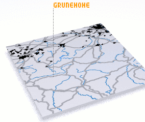 Places with similar names to Grüne Höhe, Belgium :: Disclaimer :: Information on this page comes without warranty of any kind |
||
|
Where is Grüne Höhe? Elevation and coordinates ::
Latitude (lat): 50°28'0"N Longitude (lon): 6°16'0"E
Elevation (approx.): 587m (map arrows pan, magnifying glasses zoom) |
||
|
Visiting Grüne Höhe? Hotel/Accommodation ::
Book a hotel in Grüne Höhe Travel Guide ::
Buy a travel guide for Belgium rental cars ::
car rental offers GPS waypoint ::
download a GPX waypoint (PoI) of Grüne Höhe for your GPS receiver
|
||