|
search place name
|
||
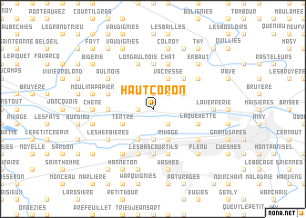
Haut Coron (Hainaut, Belgium)Haut Coron is a town in the Hainaut region of Belgium. An overview map of the region around Haut Coron is displayed below.
regional and 3d topo map of Haut Coron, Belgium ::
Haut Coron airports ::
The nearest airport is CRL - Charleroi Brussels South, located 44.1 km east of Haut Coron.
Other airports nearby include LIL - Lille Lesquin (53.5 km west), QKT - Kortrijk-vevelgem Wevelgem (57.9 km north west), BRU - Brussels Natl (Melsbroek) (65.4 km north east), ANR - Antwerp Deurne (90.1 km north east), Nearby towns ::
Baudour (1.2km west) //
Mont Garni (1.9km north) //
Mariette (2.2km south east) //
Douvrain (2.2km south east) //
Culot (2.2km north east) //
Garennes (2.2km north east) //
Le Marais (3.7km south) //
Wasmuel (3.7km south) //
Saint-Ghislain (3.9km south) //
Tertre (3.0km south west) //
Rivage (3.9km south) //
Canard (3.0km north east) //
Vacresse (3.9km north) //
Plouys (4.4km north east) //
Les Bas Courtils (5.6km south) //
Villerot (3.5km west) //
Bois de Lens (5.6km north) //
Hornu (5.7km south) //
La Quewette (4.0km south east) //
Ghlin (4.0km south east) //
Long Aulnois (5.7km north) //
Quaregnon (5.7km south) //
La Courbette (5.7km south) //
Sirault (4.0km north west) //
Chat (5.7km north) //
Herchies (5.7km north) //
Jemappes (5.1km south east) //
Les Herbières (5.1km south west) //
Haine (5.1km south west) //
[all distances 'as the bird flies' and approximate]  Places with similar names to Haut Coron, Belgium ::
Disclaimer :: Information on this page comes without warranty of any kind |
||
|
Where is Haut Coron? Elevation and coordinates ::
Latitude (lat): 50°29'0"N Longitude (lon): 3°50'0"E
Elevation (approx.): 50m (map arrows pan, magnifying glasses zoom) |
||
|
Visiting Haut Coron? Hotel/Accommodation ::
Book a hotel in Haut Coron Travel Guide ::
Buy a travel guide for Belgium rental cars ::
car rental offers GPS waypoint ::
download a GPX waypoint (PoI) of Haut Coron for your GPS receiver
|
||