|
search place name
|
||
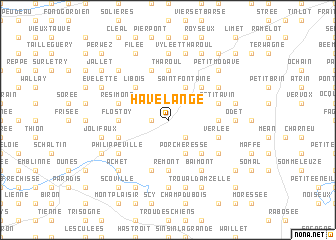
Havelange (Namur, Belgium)Havelange is a town in the Namur region of Belgium. An overview map of the region around Havelange is displayed below.
regional and 3d topo map of Havelange, Belgium ::
Havelange airports ::
The nearest airport is LGG - Liege, located 31.9 km north east of Havelange.
Other airports nearby include CRL - Charleroi Brussels South (56.0 km west), MST - Maastricht (70.0 km north east), BRU - Brussels Natl (Melsbroek) (78.3 km north west), GKE - Geilenkirchen (86.0 km north east), Nearby towns ::
Malihoux (1.2km west) //
Hietinne (1.2km west) //
Miécret (2.2km south east) //
Ossogne (2.2km north west) //
Poncia (3.9km south) //
Porcheresse (3.9km south) //
Jeneffe (3.9km south) //
Homzée (3.0km north west) //
Saint-Fontaine (3.9km north) //
Cochamp (4.4km south east) //
Chantraine (4.4km south east) //
Libois (4.4km north west) //
Pailhe (4.4km north east) //
Rémont (5.6km south) //
Flostoy (3.5km west) //
LʼObélisque (3.5km east) //
Tharoul (5.6km north) //
Quatre Verges (5.7km south) //
Belvédère (4.0km south west) //
Bormenville (4.0km south west) //
Verlée (4.0km south east) //
Tahier (5.7km north) //
Goesnes (5.7km north) //
Petit Avin (4.0km north east) //
Résimont (4.0km north west) //
Buzin (5.1km south east) //
Philippeville (5.1km south west) //
Barvaux-Condroz (6.0km south east) //
Baimont (6.0km south east) //
[all distances 'as the bird flies' and approximate] 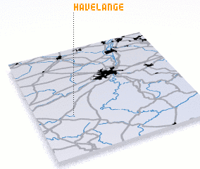
Disclaimer :: Information on this page comes without warranty of any kind |
||
|
Where is Havelange? Elevation and coordinates ::
Latitude (lat): 50°23'0"N Longitude (lon): 5°14'0"E
Elevation (approx.): 311m (map arrows pan, magnifying glasses zoom) |
||
|
Visiting Havelange? Hotel/Accommodation ::
Book a hotel in Havelange Travel Guide ::
Buy a travel guide for Belgium rental cars ::
car rental offers GPS waypoint ::
download a GPX waypoint (PoI) of Havelange for your GPS receiver
|
||