|
search place name
|
||
Heide (Oost-Vlaanderen, Belgium)Heide is a town in the Oost-Vlaanderen region of Belgium. An overview map of the region around Heide is displayed below.
regional and 3d topo map of Heide, Belgium ::

Heide airports ::
The nearest airport is QKT - Kortrijk-vevelgem Wevelgem, located 33.8 km west of Heide.
Other airports nearby include LIL - Lille Lesquin (49.6 km south west), BRU - Brussels Natl (Melsbroek) (57.5 km east), CRL - Charleroi Brussels South (66.4 km south east), ANR - Antwerp Deurne (69.7 km north east), Nearby towns ::
Stokstraat (0.0km north) //
Wijmeneer (1.2km west) //
Schorisse (1.2km west) //
Kruisstraat (1.2km west) //
Doorn (1.9km south) //
Het Bosgat (1.9km south) //
Weistraat (1.2km east) //
Hoogstraat (1.2km east) //
Steenberg (1.9km north) //
Varent (1.9km north) //
Stene (1.9km north) //
Boignenberg (2.2km north west) //
Kabuis (2.2km north west) //
Rizoi (2.2km south east) //
Buikberg (2.2km north east) //
Hokelbeke (2.3km west) //
Kerkem (2.3km west) //
Hasselhoek (2.3km west) //
Rattepoelmeers (2.3km west) //
Maarke-Kerkem (2.3km west) //
Hauwstraat (2.3km east) //
Kanakendries (2.3km east) //
Den Hul (2.3km east) //
Rovorst (2.3km east) //
Oudenhove (3.9km south) //
Breucq (3.9km south) //
Quatre Vents (3.9km south) //
Cocambre (3.9km south) //
Rooigem (3.9km north) //
[all distances 'as the bird flies' and approximate] 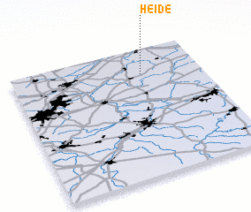 Places with similar names to Heide, Belgium ::
Disclaimer :: Information on this page comes without warranty of any kind |
||
|
Where is Heide? Elevation and coordinates ::
Latitude (lat): 50°48'0"N Longitude (lon): 3°41'0"E
Elevation (approx.): 73m (map arrows pan, magnifying glasses zoom) |
||
|
Visiting Heide? Hotel/Accommodation ::
Book a hotel in Heide Travel Guide ::
Buy a travel guide for Belgium rental cars ::
car rental offers GPS waypoint ::
download a GPX waypoint (PoI) of Heide for your GPS receiver
|
||