|
search place name
|
||
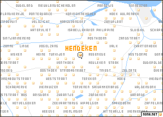
Hendeken (Oost-Vlaanderen, Belgium)Hendeken is a town in the Oost-Vlaanderen region of Belgium. An overview map of the region around Hendeken is displayed below.
regional and 3d topo map of Hendeken, Belgium ::
Hendeken airports ::
The nearest airport is WOE - Woensdrecht, located 49.8 km north east of Hendeken.
Other airports nearby include ANR - Antwerp Deurne (52.2 km east), QKT - Kortrijk-vevelgem Wevelgem (58.6 km south west), OST - Oostende (59.8 km west), BRU - Brussels Natl (Melsbroek) (65.3 km south east), Nearby towns ::
Nieuwburg (1.9km south) //
Haantje (1.2km west) //
Heuleken (1.2km west) //
Meulenhoek (1.9km north) //
Rijken (1.9km north) //
Boekhoute (1.9km north) //
Hasselstraat (2.2km south west) //
Hazelarenhoek (2.2km south west) //
De Wilde (2.2km north east) //
Kapelle (2.2km north east) //
Notelaar (2.2km north west) //
Assenede (2.3km east) //
Boekhoutestraat (2.3km west) //
Bassevelde (2.3km west) //
Doodhoek (2.3km west) //
Haven (3.7km north) //
Dankaartseke (3.9km south) //
Muikem (3.9km south) //
Meuleken (3.0km south east) //
De Maat (3.0km south east) //
Stroomstraat (3.9km south) //
Vent (3.0km south west) //
Venthoek (3.0km south west) //
Kraaigem (3.0km south west) //
Oosthoek (3.0km north west) //
Schaar (3.0km north west) //
Stoepe (4.4km south east) //
Fontein (4.4km south east) //
Rijkestraat (4.4km south west) //
[all distances 'as the bird flies' and approximate] 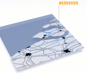 Places with similar names to Hendeken, Belgium ::
// Hindag-an (PH)
Disclaimer :: Information on this page comes without warranty of any kind |
||
|
Where is Hendeken? Elevation and coordinates ::
Latitude (lat): 51°14'0"N Longitude (lon): 3°43'0"E
(map arrows pan, magnifying glasses zoom) |
||
|
Visiting Hendeken? Hotel/Accommodation ::
Book a hotel in Hendeken Travel Guide ::
Buy a travel guide for Belgium rental cars ::
car rental offers GPS waypoint ::
download a GPX waypoint (PoI) of Hendeken for your GPS receiver
|
||