|
search place name
|
||
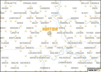
Hontoir (Namur, Belgium)Hontoir is a town in the Namur region of Belgium. An overview map of the region around Hontoir is displayed below.
regional and 3d topo map of Hontoir, Belgium ::
Hontoir airports ::
The nearest airport is CRL - Charleroi Brussels South, located 34.3 km north west of Hontoir.
Other airports nearby include LGG - Liege (57.7 km north east), BRU - Brussels Natl (Melsbroek) (73.5 km north), MST - Maastricht (95.5 km north east), ANR - Antwerp Deurne (104.5 km north), Nearby towns ::
Sommière (0.0km north) //
Haut-le-Wastia (1.9km north) //
Grange (1.9km north) //
Weillen (2.2km south west) //
Rostenne (2.2km south east) //
Les Roches (3.0km north west) //
Senennes (3.0km north east) //
Mont Noir (3.0km north east) //
Fonds de Lavois (3.9km south) //
Melin (3.9km south) //
Onhaye (3.9km south) //
Maison de Pierre (3.9km north) //
Warnant (3.9km north) //
Gerin (4.4km south west) //
Anhée (4.4km north east) //
Hun (5.6km north) //
Falaën (3.6km west) //
Marteau (3.6km west) //
Sous les Roches (3.6km east) //
Lenne (5.6km south) //
Bouvignes-sur-Meuse (4.0km south east) //
Houyèrs (5.7km north) //
Foy (4.0km north west) //
Houx (4.0km north east) //
Mont de Houx (4.0km north east) //
Mossiat (6.0km north west) //
Tricointe (6.0km north east) //
Scourseau (6.0km north east) //
Forge dʼen Haut (6.0km north east) //
[all distances 'as the bird flies' and approximate] 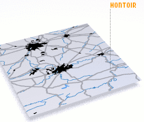 Places with similar names to Hontoir, Belgium ::
Disclaimer :: Information on this page comes without warranty of any kind |
||
|
Where is Hontoir? Elevation and coordinates ::
Latitude (lat): 50°17'0"N Longitude (lon): 4°51'0"E
Elevation (approx.): 223m (map arrows pan, magnifying glasses zoom) |
||
|
Visiting Hontoir? Hotel/Accommodation ::
Book a hotel in Hontoir Travel Guide ::
Buy a travel guide for Belgium rental cars ::
car rental offers GPS waypoint ::
download a GPX waypoint (PoI) of Hontoir for your GPS receiver
|
||