|
search place name
|
||
Hoogheultje (Antwerpen, Belgium)Hoogheultje is a town in the Antwerpen region of Belgium. An overview map of the region around Hoogheultje is displayed below.
regional and 3d topo map of Hoogheultje, Belgium ::

Hoogheultje airports ::
The nearest airport is ANR - Antwerp Deurne, located 29.5 km north west of Hoogheultje.
Other airports nearby include BRU - Brussels Natl (Melsbroek) (30.6 km south west), WOE - Woensdrecht (54.6 km north west), EIN - Eindhoven (57.0 km north east), LGG - Liege (64.2 km south east), Nearby towns ::
Moerberg (1.2km west) //
Hulshouteindeken (1.2km west) //
Goorheide (1.9km north) //
Heultje (1.9km north) //
Locht (1.9km north) //
De Hei (1.2km east) //
Stippelberg (1.2km east) //
Westmeerbeek (1.2km east) //
Vosdonken (1.9km south) //
Heiberg (2.3km west) //
Wittegracht Goorheide (3.7km north) //
Roteinde (3.7km south) //
Hooilaar (3.7km south) //
Snepken (2.3km east) //
Asbroek (2.3km east) //
Wiekevorstheide (3.0km north west) //
Houtvenne (3.0km south west) //
Varkensmarkt (3.0km south west) //
De Hand (3.9km north) //
Ramsel (3.9km south) //
Hoek (3.0km north east) //
Zoerle-Parwijs (3.0km north east) //
Venusberg (3.9km south) //
Hogenweg (3.0km south east) //
Limberg (3.0km south east) //
Wittegracht (4.4km north west) //
Plankebrug (4.4km south west) //
Vijfhuizen (4.4km north east) //
Gelendel (4.4km north east) //
[all distances 'as the bird flies' and approximate] 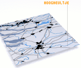 Places with similar names to Hoogheultje, Belgium ::
Disclaimer :: Information on this page comes without warranty of any kind |
||
|
Where is Hoogheultje? Elevation and coordinates ::
Latitude (lat): 51°4'0"N Longitude (lon): 4°50'0"E
Elevation (approx.): 11m (map arrows pan, magnifying glasses zoom) |
||
|
Visiting Hoogheultje? Hotel/Accommodation ::
Book a hotel in Hoogheultje Travel Guide ::
Buy a travel guide for Belgium rental cars ::
car rental offers GPS waypoint ::
download a GPX waypoint (PoI) of Hoogheultje for your GPS receiver
|
||