|
search place name
|
||
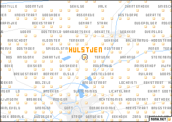
Hulstjen (Oost-Vlaanderen, Belgium)Hulstjen is a town in the Oost-Vlaanderen region of Belgium. An overview map of the region around Hulstjen is displayed below.
regional and 3d topo map of Hulstjen, Belgium ::
Hulstjen airports ::
The nearest airport is ANR - Antwerp Deurne, located 49.9 km east of Hulstjen.
Other airports nearby include WOE - Woensdrecht (53.0 km north east), QKT - Kortrijk-vevelgem Wevelgem (53.3 km south west), BRU - Brussels Natl (Melsbroek) (58.5 km south east), OST - Oostende (62.3 km west), Nearby towns ::
Hoogstraat (0.0km north) //
Zandeken (0.0km north) //
Kluizen (1.2km west) //
Geurnenhoek (1.2km east) //
Pachtgoederen (1.2km east) //
Hoge Avrij (1.9km north) //
Hoeksken (1.9km south) //
Lege Avrij (1.9km north) //
Doornzele (2.2km south east) //
Spidammenbrug (2.2km north east) //
Wippelgem (2.2km south west) //
Hulst (3.7km south) //
Terdonk (2.3km east) //
Ertvelde (3.7km north) //
Kerkbrugge (3.9km south) //
Kooibrug (3.9km south) //
Langerbrugge (3.9km south) //
Rodenhuis (3.0km south east) //
Tervenen (3.0km north west) //
Schildeken (3.0km north west) //
Rieme (3.0km north east) //
Diksmeire (3.0km south west) //
Tereken (3.9km north) //
Wittewalle (4.4km south east) //
Desteldonk (4.4km south east) //
Rechtstraat (4.4km south east) //
Elslo (4.4km south west) //
Vlassardstraat (4.4km north west) //
Kallemansputte (4.4km north east) //
[all distances 'as the bird flies' and approximate] 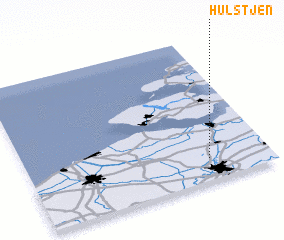 Places with similar names to Hulstjen, Belgium ::
// Holštejn (CZ)
Disclaimer :: Information on this page comes without warranty of any kind |
||
|
Where is Hulstjen? Elevation and coordinates ::
Latitude (lat): 51°9'0"N Longitude (lon): 3°45'0"E
Elevation (approx.): 3m (map arrows pan, magnifying glasses zoom) |
||
|
Visiting Hulstjen? Hotel/Accommodation ::
Book a hotel in Hulstjen Travel Guide ::
Buy a travel guide for Belgium rental cars ::
car rental offers GPS waypoint ::
download a GPX waypoint (PoI) of Hulstjen for your GPS receiver
|
||