|
search place name
|
||
Huttegem (Oost-Vlaanderen, Belgium)Huttegem is a town in the Oost-Vlaanderen region of Belgium. An overview map of the region around Huttegem is displayed below.
regional and 3d topo map of Huttegem, Belgium ::

Huttegem airports ::
The nearest airport is QKT - Kortrijk-vevelgem Wevelgem, located 23.5 km south west of Huttegem.
Other airports nearby include LIL - Lille Lesquin (49.0 km south west), OST - Oostende (54.6 km north west), BRU - Brussels Natl (Melsbroek) (69.3 km east), ANR - Antwerp Deurne (73.9 km north east), Nearby towns ::
Winnelken (0.0km north) //
Veld (1.9km north) //
IJshovedries (1.2km east) //
Het Sprietjen (1.2km east) //
Biest (1.9km south) //
Veld (2.2km north west) //
Kruishoutem (2.2km south east) //
De Lieve Dochter (2.2km south west) //
Kordaal (2.2km south west) //
Walestraat (2.3km west) //
Vossenhol (3.7km north) //
Tutegent (3.7km north) //
Nokere (3.7km south) //
Het Bunder (3.0km north east) //
Boswegel (3.0km north west) //
Lulhoek (3.0km north east) //
Olsene (3.0km north west) //
Marolle (3.0km north east) //
Vuilbroek (3.9km south) //
Lindenhoek (3.9km south) //
Berken (3.9km south) //
ʼt Joenshoek (3.9km south) //
Hooie (4.4km north west) //
Stuivenberg (5.6km south) //
Turkstraat (5.6km south) //
Ham (4.0km north west) //
Walem (5.7km south) //
Leihoek (5.7km north) //
Machelen (5.7km north) //
[all distances 'as the bird flies' and approximate] 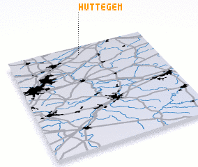 Places with similar names to Huttegem, Belgium ::
Disclaimer :: Information on this page comes without warranty of any kind |
||
|
Where is Huttegem? Elevation and coordinates ::
Latitude (lat): 50°55'0"N Longitude (lon): 3°30'0"E
Elevation (approx.): 14m (map arrows pan, magnifying glasses zoom) |
||
|
Visiting Huttegem? Hotel/Accommodation ::
Book a hotel in Huttegem Travel Guide ::
Buy a travel guide for Belgium rental cars ::
car rental offers GPS waypoint ::
download a GPX waypoint (PoI) of Huttegem for your GPS receiver
|
||