|
search place name
|
||
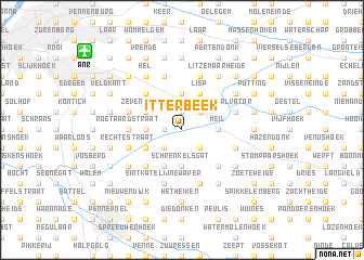
Itterbeek (Antwerpen, Belgium)Itterbeek is a town in the Antwerpen region of Belgium. An overview map of the region around Itterbeek is displayed below.
regional and 3d topo map of Itterbeek, Belgium ::
Itterbeek airports ::
The nearest airport is ANR - Antwerp Deurne, located 10.2 km north west of Itterbeek.
Other airports nearby include BRU - Brussels Natl (Melsbroek) (24.4 km south), WOE - Woensdrecht (39.7 km north), EIN - Eindhoven (68.5 km north east), CRL - Charleroi Brussels South (73.5 km south), Nearby towns ::
Donk (1.9km north) //
Boomlaar (1.9km north) //
De Hulst (1.2km west) //
Het Ven (1.2km west) //
Lierre (2.2km north east) //
Voogdij (2.2km south west) //
Blauwenhoek (2.2km south east) //
Tallaart (2.2km south east) //
Den Euster (2.2km south east) //
Dries (3.7km north) //
Klaplaar (3.7km north) //
Loverijk (2.3km west) //
Lachenen (2.3km west) //
Meil (2.3km east) //
Pullaar (2.3km west) //
Schrenkelsgat (3.7km south) //
Muilshoek (3.7km south) //
Zeven Huizen (3.0km north west) //
Lisp (3.9km north) //
Allierseheide (3.9km north) //
Duffel (3.0km south west) //
Dries (3.9km south) //
Lentse Heide (3.9km south) //
Boshoek (4.4km north west) //
Kwaden Houw (4.4km south east) //
Bredeheide (4.4km south west) //
Bosmolen (4.4km south east) //
Roetaardstraat (3.5km west) //
Roetaardshoek (3.5km west) //
[all distances 'as the bird flies' and approximate] 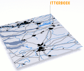 Places with similar names to Itterbeek, Belgium ::
Disclaimer :: Information on this page comes without warranty of any kind |
||
|
Where is Itterbeek? Elevation and coordinates ::
Latitude (lat): 51°7'0"N Longitude (lon): 4°33'0"E
Elevation (approx.): 2m (map arrows pan, magnifying glasses zoom) |
||
|
Visiting Itterbeek? Hotel/Accommodation ::
Book a hotel in Itterbeek Travel Guide ::
Buy a travel guide for Belgium rental cars ::
car rental offers GPS waypoint ::
download a GPX waypoint (PoI) of Itterbeek for your GPS receiver
|
||