|
search place name
|
||
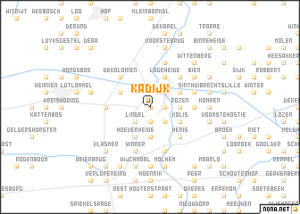
Kadijk (Limburg, Belgium)Kadijk is a town in the Limburg region of Belgium. An overview map of the region around Kadijk is displayed below.
regional and 3d topo map of Kadijk, Belgium ::
Kadijk airports ::
The nearest airport is EIN - Eindhoven, located 26.1 km north of Kadijk.
Other airports nearby include MST - Maastricht (42.0 km south east), GKE - Geilenkirchen (52.3 km south east), LGG - Liege (64.5 km south), ANR - Antwerp Deurne (66.9 km west), Nearby towns ::
Neerpelt (0.0km north) //
Houtmolen (0.0km north) //
Overpelt (0.0km north) //
Hoverseinde (1.2km east) //
Haspershoven (1.2km east) //
Hoeksken (1.2km east) //
Hasselt (1.9km south) //
De Riet (1.9km south) //
Neus (1.9km south) //
Broeseind (2.2km north east) //
Heesakker (2.2km south east) //
Lindel (2.2km south west) //
Rozen (2.3km east) //
Bosheide (3.7km south) //
Heerstraat (3.0km north east) //
Boseind (3.0km north east) //
Boelehoel (3.0km north east) //
Lage Heide (3.9km north) //
Haaienhoek (3.9km north) //
Grote Heide (3.9km north) //
Herent (3.0km south east) //
Kolis (3.0km south east) //
De Grote Barreel (3.0km north west) //
Hoeven (3.9km south) //
Hoeverheide (3.9km south) //
Hoeven (4.4km north east) //
Heris (4.4km south east) //
De Koloniën (4.4km north west) //
Riet (3.5km east) //
[all distances 'as the bird flies' and approximate] 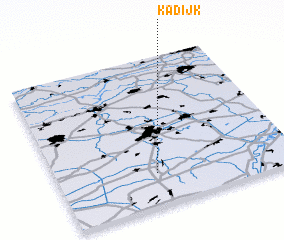 Places with similar names to Kadijk, Belgium ::
// Cadajug (PH)
// Cudjoe Key (US)
// Goudjougou (TD)
// Kidjagué (TD)
// Kodjoko (TD)
// Guatajiagua (SV)
// Kot Jakka (PK)
// Cadaujac (FR)
// Kadijk (NL)
// Koedijk (NL)
Disclaimer :: Information on this page comes without warranty of any kind |
||
|
Where is Kadijk? Elevation and coordinates ::
Latitude (lat): 51°13'0"N Longitude (lon): 5°25'0"E
Elevation (approx.): 41m (map arrows pan, magnifying glasses zoom) |
||
|
Visiting Kadijk? Hotel/Accommodation ::
Book a hotel in Kadijk Travel Guide ::
Buy a travel guide for Belgium rental cars ::
car rental offers GPS waypoint ::
download a GPX waypoint (PoI) of Kadijk for your GPS receiver
|
||