|
search place name
|
||
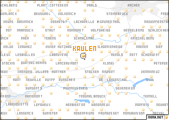
Kaulen (Liège, Belgium)Kaulen is a town in the Liège region of Belgium. An overview map of the region around Kaulen is displayed below.
regional and 3d topo map of Kaulen, Belgium ::
Kaulen airports ::
The nearest airport is MST - Maastricht, located 31.7 km north west of Kaulen.
Other airports nearby include GKE - Geilenkirchen (32.9 km north), LGG - Liege (39.5 km west), MGL - Moenchengladbach Monchengladbach (72.0 km north east), CGN - Cologne Koln Bonn (83.6 km east), Nearby towns ::
Lontzen (1.9km north) //
Herbesthal (1.2km west) //
Rabotrath (1.2km east) //
Busch (2.2km north west) //
Nereth (2.2km south west) //
Gemehret (2.2km south east) //
Walhornerfeld (2.3km east) //
Marzelheide (2.3km east) //
Hirtz (3.7km north) //
Donnerkaul (3.7km north) //
Schmalgraf (3.7km north) //
Overoth (3.7km south) //
Astenet (3.0km north east) //
Mützhagen (3.0km north west) //
Lanceaumont (3.0km south west) //
Heggen (3.0km south west) //
Welkenraedt (3.0km south west) //
Stockem (3.9km south) //
Montzen (4.4km north west) //
Fossey (4.4km north east) //
Birken (4.4km north west) //
Eupen (4.4km south east) //
Baelen (4.4km south west) //
La Calamine (5.6km north) //
Membach (5.6km south) //
La Bruyère (3.5km west) //
Walhornerheide (4.0km north east) //
Ruyff (4.0km north west) //
Walhorn (4.0km north east) //
[all distances 'as the bird flies' and approximate]  Places with similar names to Kaulen, Belgium ::
Disclaimer :: Information on this page comes without warranty of any kind |
||
|
Where is Kaulen? Elevation and coordinates ::
Latitude (lat): 50°40'0"N Longitude (lon): 6°0'0"E
Elevation (approx.): 256m (map arrows pan, magnifying glasses zoom) |
||
|
Visiting Kaulen? Hotel/Accommodation ::
Book a hotel in Kaulen Travel Guide ::
Buy a travel guide for Belgium rental cars ::
car rental offers GPS waypoint ::
download a GPX waypoint (PoI) of Kaulen for your GPS receiver
|
||