|
search place name
|
||
Kesselt (Limburg, Belgium)Kesselt is a town in the Limburg region of Belgium. An overview map of the region around Kesselt is displayed below.
regional and 3d topo map of Kesselt, Belgium ::

nearby GPS traces from timatio ::
Kesselt airports ::
The nearest airport is MST - Maastricht, located 13.9 km north east of Kesselt.
Other airports nearby include LGG - Liege (25.0 km south west), GKE - Geilenkirchen (33.1 km north east), EIN - Eindhoven (70.7 km north), MGL - Moenchengladbach Monchengladbach (76.4 km north east), Nearby towns ::
Laaffelterberg (1.9km south) //
Laaffelt (1.2km west) //
Vroenhoven (2.2km south east) //
Hees (2.2km north west) //
Oud-Vroenhoven (2.3km east) //
Wolder (2.3km east) //
Heukelom (3.7km south) //
Vlijtingen (2.3km west) //
Ellicht (2.3km west) //
Sint-Antoniusberg (3.7km north) //
Briegden (3.7km north) //
Zussen (3.9km south) //
Riemst (3.9km south) //
Bolder (3.9km south) //
Siberg (3.0km south west) //
Veldwezelt (3.9km north) //
Rosmeer (3.0km north west) //
Root (3.0km north west) //
Kompveld (3.9km north) //
Meer (4.4km south west) //
Meerberg (4.4km south west) //
Eigenbilzen (4.4km north west) //
Zichen-Zussen-Bolder (5.6km south) //
Berg (5.6km north) //
Romont (5.7km south) //
Herderen (4.0km south west) //
Kanne (4.0km south east) //
Neerkanne (4.0km south east) //
Maasmechelen (4.0km south east) //
[all distances 'as the bird flies' and approximate] 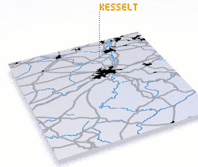 Places with similar names to Kesselt, Belgium ::
Disclaimer :: Information on this page comes without warranty of any kind |
||
|
Where is Kesselt? Elevation and coordinates ::
Latitude (lat): 50°50'0"N Longitude (lon): 5°37'0"E
Elevation (approx.): 94m (map arrows pan, magnifying glasses zoom) |
||
|
Visiting Kesselt? Hotel/Accommodation ::
Book a hotel in Kesselt Travel Guide ::
Buy a travel guide for Belgium rental cars ::
car rental offers GPS waypoint ::
download a GPX waypoint (PoI) of Kesselt for your GPS receiver
|
||