|
search place name
|
||
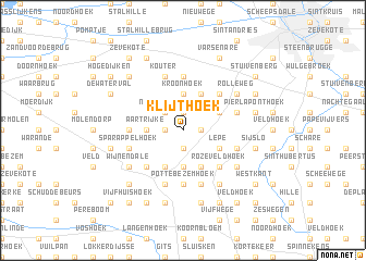
Klijthoek (West-Vlaanderen, Belgium)Klijthoek is a town in the West-Vlaanderen region of Belgium. An overview map of the region around Klijthoek is displayed below.
regional and 3d topo map of Klijthoek, Belgium ::
Klijthoek airports ::
The nearest airport is OST - Oostende, located 20.0 km north west of Klijthoek.
Other airports nearby include QKT - Kortrijk-vevelgem Wevelgem (33.9 km south), LIL - Lille Lesquin (61.7 km south), CQF - Calais Dunkerque (83.3 km west), WOE - Woensdrecht (93.1 km north east), Nearby towns ::
Klabouterie (1.9km north) //
Hollevoorde (1.2km east) //
Berkenhaag (1.2km west) //
Rozeboom (1.9km south) //
Noordstraat (2.2km north west) //
Kroonhoek (3.7km north) //
De Keijorum (3.7km north) //
Aartrijke (2.3km west) //
Berg op Zoom (3.7km south) //
Zedelgem (3.9km north) //
De Leeuw (3.0km north east) //
Lepe (3.0km south east) //
De Stroolput (3.0km south east) //
Koornbloem (3.9km south) //
Poorterhoek (3.9km south) //
Kezelberg (4.4km north east) //
De Pleine (4.4km north east) //
Rozeveldhoek (4.4km south east) //
Bergen (4.4km south east) //
Hoge (4.4km south west) //
Snellegem (5.6km north) //
Gemeneveld (3.5km west) //
Pottebezemhoek (5.6km south) //
Merkenveld (4.0km north east) //
De Arend (4.0km north east) //
Griete (5.7km south) //
Kouter (5.7km north) //
Veldegem (4.0km south east) //
Sparappelhoek (4.0km south west) //
[all distances 'as the bird flies' and approximate]  Places with similar names to Klijthoek, Belgium ::
// Klijthoek (BE)
Disclaimer :: Information on this page comes without warranty of any kind |
||
|
Where is Klijthoek? Elevation and coordinates ::
Latitude (lat): 51°7'0"N Longitude (lon): 3°7'0"E
Elevation (approx.): 24m (map arrows pan, magnifying glasses zoom) |
||
|
Visiting Klijthoek? Hotel/Accommodation ::
Book a hotel in Klijthoek Travel Guide ::
Buy a travel guide for Belgium rental cars ::
car rental offers GPS waypoint ::
download a GPX waypoint (PoI) of Klijthoek for your GPS receiver
|
||