|
search place name
|
||
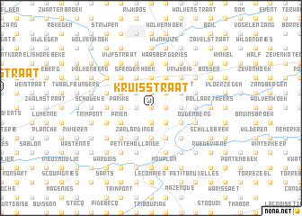
Kruisstraat (Oost-Vlaanderen, Belgium)Kruisstraat is a town in the Oost-Vlaanderen region of Belgium. An overview map of the region around Kruisstraat is displayed below.
regional and 3d topo map of Kruisstraat, Belgium ::
Kruisstraat airports ::
The nearest airport is QKT - Kortrijk-vevelgem Wevelgem, located 44.5 km west of Kruisstraat.
Other airports nearby include BRU - Brussels Natl (Melsbroek) (47.7 km east), CRL - Charleroi Brussels South (56.8 km south east), LIL - Lille Lesquin (58.1 km south west), ANR - Antwerp Deurne (63.1 km north east), Nearby towns ::
Ottergemsestraat (0.0km north) //
Pikkelgem (0.0km north) //
Deftinge (0.0km north) //
Dries (0.0km north) //
Breed Bijl (1.2km west) //
Goeferdinge (1.9km south) //
Den Hoek (1.9km south) //
Oudenkerkenhoek (1.9km north) //
Larebeek (1.9km north) //
Wassegem (1.9km north) //
Lindeveldeken (1.9km north) //
Opstaldries (1.9km north) //
Broek (1.2km east) //
Den Berg (2.2km north west) //
Sint-Martens-Lierde (2.2km north west) //
Hoogstraat (2.2km north west) //
Duitsenbroek (2.2km south east) //
Repstraat (2.2km south east) //
Gemeldorp (2.2km north east) //
Watermolenstraat (2.2km north east) //
Hemelveerdegem (2.2km north east) //
Kloddestraat (2.2km north east) //
Gelategem (2.3km west) //
Boshoek (2.3km west) //
Hollebeekstraat (2.3km west) //
Parike (2.3km west) //
Planken (3.7km south) //
Gelembeke (3.7km south) //
Polenak (3.7km north) //
[all distances 'as the bird flies' and approximate]  Places with similar names to Kruisstraat, Belgium ::
// Christerode (DE)
// Kruisstraat (NL)
// Kruisstraat (NL)
// Karstraat (NL)
// Groß Dratow (DE)
// Goorstraat (BE)
// Karrestraat (BE)
// Kruisstraat (BE)
// Kruisstraat (BE)
// Kruisstraat (BE)
Disclaimer :: Information on this page comes without warranty of any kind |
||
|
Where is Kruisstraat? Elevation and coordinates ::
Latitude (lat): 50°47'0"N Longitude (lon): 3°50'0"E
Elevation (approx.): 51m (map arrows pan, magnifying glasses zoom) |
||
|
Visiting Kruisstraat? Hotel/Accommodation ::
Book a hotel in Kruisstraat Travel Guide ::
Buy a travel guide for Belgium rental cars ::
car rental offers GPS waypoint ::
download a GPX waypoint (PoI) of Kruisstraat for your GPS receiver
|
||