|
search place name
|
||
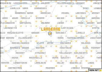
Landenne (Liège, Belgium)Landenne is a town in the Liège region of Belgium. An overview map of the region around Landenne is displayed below.
regional and 3d topo map of Landenne, Belgium ::
Landenne airports ::
The nearest airport is LGG - Liege, located 29.9 km north east of Landenne.
Other airports nearby include CRL - Charleroi Brussels South (44.0 km west), BRU - Brussels Natl (Melsbroek) (59.4 km north west), MST - Maastricht (66.3 km north east), GKE - Geilenkirchen (84.8 km north east), Nearby towns ::
Tramaka (0.0km north) //
Velaine (0.0km north) //
Seilles (1.9km south) //
Les Malheurs (2.2km north east) //
Forseilles (2.2km north east) //
Petit-Waret (2.2km north west) //
Chant dʼOiseaux (2.2km south west) //
Waret-lʼÉvêque (3.7km north) //
Surlemez (2.4km east) //
Anton (3.7km south) //
Héron (3.9km north) //
Halbosa (3.9km north) //
Reppe (3.0km south east) //
Peu dʼEau (3.9km south) //
Rouvroy (3.9km south) //
Lavoir (4.4km north east) //
Andenne (4.4km south east) //
Sclayn (4.4km south west) //
Chavée (3.5km east) //
Hingeon (3.5km west) //
Marsinne (4.0km north east) //
Sur les Trixhes (4.0km north east) //
Groynne (5.7km south) //
Vezin (4.0km south west) //
Melroy (4.0km south west) //
Andenelle (4.0km south east) //
Gochenée (5.1km north west) //
Bolsée (6.0km north east) //
Boing (6.0km north east) //
[all distances 'as the bird flies' and approximate] 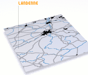 Places with similar names to Landenne, Belgium ::
Disclaimer :: Information on this page comes without warranty of any kind |
||
|
Where is Landenne? Elevation and coordinates ::
Latitude (lat): 50°31'0"N Longitude (lon): 5°4'0"E
Elevation (approx.): 176m (map arrows pan, magnifying glasses zoom) |
||
|
Visiting Landenne? Hotel/Accommodation ::
Book a hotel in Landenne Travel Guide ::
Buy a travel guide for Belgium rental cars ::
car rental offers GPS waypoint ::
download a GPX waypoint (PoI) of Landenne for your GPS receiver
|
||