|
search place name
|
||
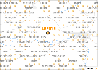
Le Fays (Namur, Belgium)Le Fays is a town in the Namur region of Belgium. An overview map of the region around Le Fays is displayed below.
regional and 3d topo map of Le Fays, Belgium ::
Le Fays airports ::
The nearest airport is CRL - Charleroi Brussels South, located 21.0 km west of Le Fays.
Other airports nearby include BRU - Brussels Natl (Melsbroek) (51.9 km north), LGG - Liege (52.7 km east), ANR - Antwerp Deurne (83.0 km north), MST - Maastricht (87.4 km north east), Nearby towns ::
Temploux (1.9km north) //
Grandes Tombales (1.9km north) //
Petites Tombales (1.9km north) //
Loyers (1.2km east) //
Floriffoux (2.2km south east) //
Jodion (2.2km south west) //
Soye (2.2km south west) //
Les Comognes (2.4km east) //
Comogne (2.4km east) //
Preyat (3.7km south) //
Suarlée (3.0km north east) //
Saint-Pierre (3.9km south) //
Franière (3.9km south) //
Malpas (3.9km south) //
Isnes (4.4km north west) //
Florivaux (4.4km north west) //
Floreffe (4.4km south east) //
Deminche (4.4km south west) //
Fond de Malonne (4.4km south east) //
Tremouroux (5.6km south) //
La Sauvenière (3.5km west) //
Ordin (3.5km west) //
Flawinne (3.5km east) //
Raidit (5.6km north) //
Spy (4.0km north west) //
Trieux de Goyet (4.0km north west) //
Les Fourches Deminche (5.7km south) //
Froide Bise (5.7km south) //
Le Rabot (4.0km south west) //
[all distances 'as the bird flies' and approximate]  Places with similar names to Le Fays, Belgium ::
Disclaimer :: Information on this page comes without warranty of any kind |
||
|
Where is Le Fays? Elevation and coordinates ::
Latitude (lat): 50°28'0"N Longitude (lon): 4°45'0"E
Elevation (approx.): 196m (map arrows pan, magnifying glasses zoom) |
||
|
Visiting Le Fays? Hotel/Accommodation ::
Book a hotel in Le Fays Travel Guide ::
Buy a travel guide for Belgium rental cars ::
car rental offers GPS waypoint ::
download a GPX waypoint (PoI) of Le Fays for your GPS receiver
|
||