|
search place name
|
||
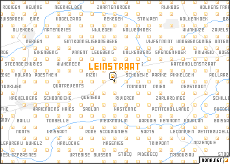
Leinstraat (Oost-Vlaanderen, Belgium)Leinstraat is a town in the Oost-Vlaanderen region of Belgium. An overview map of the region around Leinstraat is displayed below.
regional and 3d topo map of Leinstraat, Belgium ::
Leinstraat airports ::
The nearest airport is QKT - Kortrijk-vevelgem Wevelgem, located 37.5 km west of Leinstraat.
Other airports nearby include LIL - Lille Lesquin (51.8 km south west), BRU - Brussels Natl (Melsbroek) (54.5 km east), CRL - Charleroi Brussels South (62.4 km south east), ANR - Antwerp Deurne (68.2 km north east), Nearby towns ::
Boekouter (0.0km north) //
Zwalmstraat (1.2km west) //
Ronsstraat (1.2km west) //
Hutte (1.2km west) //
Sainte-Anne (1.9km south) //
Bosstraat (1.9km south) //
Bois (1.9km south) //
Haaiershoek (1.9km north) //
Ten Berge (1.2km east) //
Verrebeke (1.2km east) //
Opbrakel (1.2km east) //
Lumenne (2.2km south west) //
Den Hul (2.2km north west) //
Kanakendries (2.2km north west) //
Hauwstraat (2.2km north west) //
Rovorst (2.2km north west) //
Meerbeke (2.2km north east) //
Ribeke (2.2km north east) //
Twaalf Bunders (2.2km north east) //
Rizoi (2.3km west) //
Hurdumont (3.7km south) //
Plachette (3.7km south) //
Smeistraat (3.7km north) //
Hoogbos (2.3km east) //
Driestenbroek (2.3km east) //
Schudewe (2.3km east) //
Houppe (3.0km south west) //
Planche (3.9km south) //
Emnuez (3.9km south) //
[all distances 'as the bird flies' and approximate] 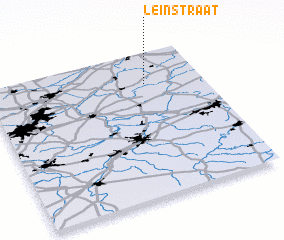 Places with similar names to Leinstraat, Belgium ::
// Leenstraat (BE)
// Leenstraat (BE)
Disclaimer :: Information on this page comes without warranty of any kind |
||
|
Where is Leinstraat? Elevation and coordinates ::
Latitude (lat): 50°47'0"N Longitude (lon): 3°44'0"E
Elevation (approx.): 61m (map arrows pan, magnifying glasses zoom) |
||
|
Visiting Leinstraat? Hotel/Accommodation ::
Book a hotel in Leinstraat Travel Guide ::
Buy a travel guide for Belgium rental cars ::
car rental offers GPS waypoint ::
download a GPX waypoint (PoI) of Leinstraat for your GPS receiver
|
||