|
search place name
|
||
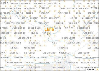
Lens (Hainaut, Belgium)Lens is a town in the Hainaut region of Belgium. An overview map of the region around Lens is displayed below.
regional and 3d topo map of Lens, Belgium ::
Lens airports ::
The nearest airport is CRL - Charleroi Brussels South, located 40.6 km east of Lens.
Other airports nearby include BRU - Brussels Natl (Melsbroek) (56.8 km north east), QKT - Kortrijk-vevelgem Wevelgem (57.4 km north west), LIL - Lille Lesquin (57.5 km west), ANR - Antwerp Deurne (81.3 km north east), Nearby towns ::
Rivage (0.0km north) //
Le Long Pont (1.2km east) //
Grand Hameau (1.2km west) //
Quillies (1.2km east) //
Thy (1.2km west) //
Erbaut (2.2km south west) //
Les Bouloirs (2.2km north east) //
Bruyère (2.4km west) //
Erbisoeul (3.9km south) //
Pavé (3.9km south) //
Masnuy-Saint-Jean (3.0km south east) //
Jurbise (3.0km south east) //
Montignies-lez-Lens (3.0km north east) //
Les Trieux (3.9km north) //
Bolignies (3.9km north) //
Haute Rue (3.9km north) //
Cambron-Casteau (3.9km north) //
Sainte-Anne (3.9km north) //
Plouys (4.4km south west) //
Potray (4.4km north east) //
Hembise (4.4km north east) //
Cambron-Saint-Vincent (4.4km north east) //
Tambour (4.4km north east) //
Colroy (3.5km west) //
Chat (4.0km south west) //
Herchies (4.0km south west) //
Masnuy-Saint-Pierre (4.0km south east) //
Les Bailles (4.0km north west) //
Bauffe (4.0km north west) //
[all distances 'as the bird flies' and approximate] 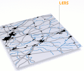 Places with similar names to Lens, Belgium ::
Disclaimer :: Information on this page comes without warranty of any kind |
||
|
Where is Lens? Elevation and coordinates ::
Latitude (lat): 50°33'0"N Longitude (lon): 3°54'0"E
Elevation (approx.): 68m (map arrows pan, magnifying glasses zoom) |
||
|
Visiting Lens? Hotel/Accommodation ::
Book a hotel in Lens Travel Guide ::
Buy a travel guide for Belgium rental cars ::
car rental offers GPS waypoint ::
download a GPX waypoint (PoI) of Lens for your GPS receiver
|
||