|
search place name
|
||
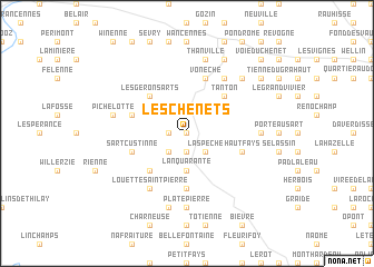
Les Chenêts (Namur, Belgium)Les Chenêts is a town in the Namur region of Belgium. An overview map of the region around Les Chenêts is displayed below.
regional and 3d topo map of Les Chenêts, Belgium ::
Les Chenêts airports ::
The nearest airport is CRL - Charleroi Brussels South, located 61.3 km north west of Les Chenêts.
Other airports nearby include LGG - Liege (76.9 km north east), LUX - Luxemburg Luxembourg (99.5 km south east), RHE - Reims Champagne (102.7 km south west), BRU - Brussels Natl (Melsbroek) (104.2 km north), Nearby towns ::
Malvoisin (0.0km north) //
Les Quartiers (1.2km west) //
Gribelle (1.9km south) //
La Spèche (2.2km south east) //
Patignies (2.2km south west) //
LʼAn Quarante (3.7km south) //
Tanton (4.4km north east) //
Les Géronsarts (4.4km north west) //
Gedinne (4.4km south west) //
Louette-Saint-Denis (5.6km south) //
Vonêche (5.7km north) //
Vencimont (4.0km north west) //
Haut-Fays (4.0km south east) //
Sart-Custinne (4.0km south west) //
Froidfontaine (6.0km north east) //
Virée à lʼGoufre (6.0km north east) //
Le Goule (6.0km north east) //
Louette-Saint-Pierre (6.0km south west) //
Monseufoy (4.8km east) //
Plate Pierre (7.4km south) //
Thanville (7.5km north) //
Pichelotte (5.1km west) //
Houdremont (7.5km south) //
Lestape (6.6km north east) //
Les Auges (7.8km north) //
Tienne des Gattes (7.8km north) //
Tienne du Chenet (7.3km north east) //
Honnay (8.8km north east) //
Voie du Chenet (8.8km north east) //
[all distances 'as the bird flies' and approximate] 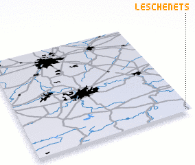 Places with similar names to Les Chenêts, Belgium ::
// Los Cantos (PA)
// Los Segundos (PA)
// Las Cañadas (ES)
// Las Cañadas (ES)
// Las Cañadas (ES)
// Las Cañadas (ES)
// Las Cañadas (ES)
// Las Cañadas (ES)
// Las Cañadas (ES)
// Los Cantos (ES)
Disclaimer :: Information on this page comes without warranty of any kind |
||
|
Where is Les Chenêts? Elevation and coordinates ::
Latitude (lat): 50°1'0"N Longitude (lon): 4°58'0"E
Elevation (approx.): 403m (map arrows pan, magnifying glasses zoom) |
||
|
Visiting Les Chenêts? Hotel/Accommodation ::
Book a hotel in Les Chenêts Travel Guide ::
Buy a travel guide for Belgium rental cars ::
car rental offers GPS waypoint ::
download a GPX waypoint (PoI) of Les Chenêts for your GPS receiver
|
||