|
search place name
|
||
Les Empires (Hainaut, Belgium)Les Empires is a town in the Hainaut region of Belgium. An overview map of the region around Les Empires is displayed below.
regional and 3d topo map of Les Empires, Belgium ::

Les Empires airports ::
The nearest airport is LIL - Lille Lesquin, located 15.0 km south west of Les Empires.
Other airports nearby include QKT - Kortrijk-vevelgem Wevelgem (23.0 km north), OST - Oostende (71.2 km north west), CRL - Charleroi Brussels South (84.8 km east), BRU - Brussels Natl (Melsbroek) (90.5 km east), Nearby towns ::
Les Marais (0.0km north) //
Hertain (0.0km north) //
LʼÉpine (1.2km west) //
Moulinel (1.2km west) //
Blandain (1.2km east) //
Cocriamont (1.2km east) //
Lamain (1.9km south) //
Cornet (2.2km north west) //
Trieu-de-Wazon (2.2km north west) //
Templeuve (2.2km north west) //
Houilly (2.2km north east) //
Fourcroix (2.2km north east) //
Haudion (2.2km south east) //
Hauterue (3.7km north) //
Tréquière (2.4km west) //
Honnevain (2.4km east) //
Quatre Chins (3.7km south) //
Hulans (3.9km north) //
Forzeau (3.0km north west) //
Estafflers (3.0km north west) //
Vert Marais (3.9km north) //
Faluzeau (3.9km north) //
Épinette (3.9km north) //
Baisieux (3.0km south west) //
Mont Garni (3.0km north east) //
Ruage (3.0km north east) //
Marquain (3.0km south east) //
Orchies (4.4km north west) //
Chaos (4.4km north west) //
[all distances 'as the bird flies' and approximate] 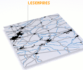 Places with similar names to Les Empires, Belgium ::
Disclaimer :: Information on this page comes without warranty of any kind |
||
|
Where is Les Empires? Elevation and coordinates ::
Latitude (lat): 50°37'0"N Longitude (lon): 3°17'0"E
Elevation (approx.): 27m (map arrows pan, magnifying glasses zoom) |
||
|
Visiting Les Empires? Hotel/Accommodation ::
Book a hotel in Les Empires Travel Guide ::
Buy a travel guide for Belgium rental cars ::
car rental offers GPS waypoint ::
download a GPX waypoint (PoI) of Les Empires for your GPS receiver
|
||