|
search place name
|
||
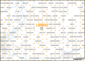
Loneux (Liège, Belgium)Loneux is a town in the Liège region of Belgium. An overview map of the region around Loneux is displayed below.
regional and 3d topo map of Loneux, Belgium ::
Loneux airports ::
The nearest airport is LGG - Liege, located 23.4 km west of Loneux.
Other airports nearby include MST - Maastricht (25.4 km north), GKE - Geilenkirchen (36.5 km north east), MGL - Moenchengladbach Monchengladbach (79.9 km north east), EIN - Eindhoven (89.6 km north), Nearby towns ::
Neuve Haie (0.0km north) //
Julémont (0.0km north) //
Grétry (1.9km south) //
Bolland (1.9km south) //
Neuve Cour (1.9km south) //
Mauhin (1.9km north) //
Heusière (1.9km north) //
Trou du Bois (2.2km south east) //
Hacboister (2.2km south west) //
Asse (2.2km north east) //
Malterie (2.2km north west) //
Saint-André (2.2km north west) //
Groumette (2.3km east) //
Fawes (2.3km east) //
Noblehaie (3.7km south) //
Sarémont (3.7km south) //
Neufchâteau (3.7km north) //
Néche (2.3km west) //
Mortier (2.3km west) //
Privot (3.0km south east) //
Charneux (3.0km south east) //
Sauvenière (3.0km south east) //
Warrimont (3.0km south east) //
Belle Fontaine (3.9km south) //
Holliguette (3.0km north east) //
Vaux (3.9km south) //
Fechereux (3.9km north) //
Les Waides (3.9km north) //
Blegny (3.0km south west) //
[all distances 'as the bird flies' and approximate] 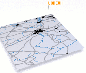 Places with similar names to Loneux, Belgium ::
Disclaimer :: Information on this page comes without warranty of any kind |
||
|
Where is Loneux? Elevation and coordinates ::
Latitude (lat): 50°41'0"N Longitude (lon): 5°46'0"E
Elevation (approx.): 199m (map arrows pan, magnifying glasses zoom) |
||
|
Visiting Loneux? Hotel/Accommodation ::
Book a hotel in Loneux Travel Guide ::
Buy a travel guide for Belgium rental cars ::
car rental offers GPS waypoint ::
download a GPX waypoint (PoI) of Loneux for your GPS receiver
|
||