|
search place name
|
||
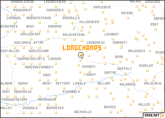
Longchamps (Luxembourg, Belgium)Longchamps is a town in the Luxembourg region of Belgium. An overview map of the region around Longchamps is displayed below.
regional and 3d topo map of Longchamps, Belgium ::
Longchamps airports ::
The nearest airport is LGG - Liege, located 57.0 km north west of Longchamps.
Other airports nearby include SPM - Spangdahlem Ab (62.0 km south east), LUX - Luxemburg Luxembourg (69.9 km south), ZQF - Trier Fohren (74.1 km south east), MST - Maastricht (77.0 km north), Nearby towns ::
Bovigny (0.4km south west) //
Honvelez (1.0km north) //
Rahy (1.2km north east) //
Courtil (1.5km south west) //
Cierreux (2.1km north) //
Néon (3.0km south) //
Chîmonti (3.0km south) //
Halconreux (3.5km south) //
Rogery (2.8km north east) //
Provèdroux (3.4km north west) //
Le Rovreux (3.3km north east) //
Bèche (4.2km north) //
Salmchâteau (4.6km north) //
Lebeuleux (4.8km south) //
La Concession (3.1km east) //
Gouvy (4.8km south) //
Joffen (3.4km east) //
La Haie (4.2km north east) //
Comté (5.2km north west) //
Lassain (4.0km west) //
Neuville (6.1km north) //
Vielsalm (6.5km north) //
Clermont (6.6km south) //
Limerlé (6.6km south) //
Baclain (4.9km south west) //
Geisbour (4.6km east) //
Rencheux (7.1km north) //
Priesmont (7.3km north) //
Baraque Dumont (7.0km south) //
[all distances 'as the bird flies' and approximate] 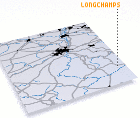 Places with similar names to Longchamps, Belgium ::
// Longchamps (BE)
// Longchamps (FR)
// Longchamps (AR)
// Longchamps (FR)
// Longchamps (BE)
// Longchamps (BE)
Disclaimer :: Information on this page comes without warranty of any kind |
||
|
Where is Longchamps? Elevation and coordinates ::
Latitude (lat): 50°13'35"N Longitude (lon): 5°55'16"E
Elevation (approx.): 446m (map arrows pan, magnifying glasses zoom) |
||
|
Visiting Longchamps? Hotel/Accommodation ::
Book a hotel in Longchamps Travel Guide ::
Buy a travel guide for Belgium rental cars ::
car rental offers GPS waypoint ::
download a GPX waypoint (PoI) of Longchamps for your GPS receiver
|
||