|
search place name
|
||
Marsnil (Limburg, Belgium)Marsnil is a town in the Limburg region of Belgium. An overview map of the region around Marsnil is displayed below.
regional and 3d topo map of Marsnil, Belgium ::

Marsnil airports ::
The nearest airport is LGG - Liege, located 16.9 km south east of Marsnil.
Other airports nearby include MST - Maastricht (38.7 km north east), GKE - Geilenkirchen (58.4 km north east), BRU - Brussels Natl (Melsbroek) (58.8 km west), CRL - Charleroi Brussels South (67.0 km south west), Nearby towns ::
Heers (0.0km north) //
Egoven (1.2km west) //
Opheers (1.9km south) //
Klein-Gelmen (2.2km north west) //
Batsheers (2.2km south west) //
Overbroek (2.2km north west) //
Groenenschild (2.2km north west) //
Veulen (2.2km north east) //
Oleye (3.7km south) //
Mettekoven (3.7km north) //
Horpmaal (2.3km east) //
Groot-Gelmen (3.9km north) //
Vrijheers (3.0km north west) //
Engelmanshoven (3.0km north west) //
Mechelen-Bovelingen (3.0km south west) //
Gelinden (3.0km north west) //
Lantremange (3.9km south) //
Gutschoven (3.0km north east) //
Saffraanberg (4.4km north west) //
Kranenberg (4.4km south west) //
Rukkelingen-Loon (4.4km south west) //
Broekom (4.4km north east) //
Op den Beek (4.4km north east) //
Helshoven (5.6km north) //
Boekhout (3.5km west) //
Hartenge (5.7km south) //
Pousset (5.7km south) //
Gotem (5.7km north) //
Ramkin (4.0km south east) //
[all distances 'as the bird flies' and approximate] 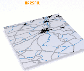 Places with similar names to Marsnil, Belgium ::
Disclaimer :: Information on this page comes without warranty of any kind |
||
|
Where is Marsnil? Elevation and coordinates ::
Latitude (lat): 50°45'0"N Longitude (lon): 5°17'0"E
Elevation (approx.): 88m (map arrows pan, magnifying glasses zoom) |
||
|
Visiting Marsnil? Hotel/Accommodation ::
Book a hotel in Marsnil Travel Guide ::
Buy a travel guide for Belgium rental cars ::
car rental offers GPS waypoint ::
download a GPX waypoint (PoI) of Marsnil for your GPS receiver
|
||