|
search place name
|
||
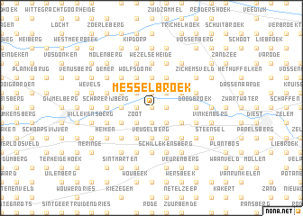
Messelbroek (Brabant, Belgium)Messelbroek is a town in the Brabant region of Belgium. An overview map of the region around Messelbroek is displayed below.
regional and 3d topo map of Messelbroek, Belgium ::
Messelbroek airports ::
The nearest airport is BRU - Brussels Natl (Melsbroek), located 33.4 km west of Messelbroek.
Other airports nearby include ANR - Antwerp Deurne (39.3 km north west), LGG - Liege (54.0 km south east), EIN - Eindhoven (58.8 km north east), MST - Maastricht (59.6 km east), Nearby towns ::
De Zavelbemden (0.0km north) //
Wijngaardberg (0.0km north) //
Laker Velden (1.2km west) //
Krekelberg (1.2km west) //
Testelt (1.2km east) //
Schutterveld (1.9km south) //
Heide (1.9km north) //
Hanenberg (1.9km north) //
Heibergen (1.9km north) //
Mannenberg (1.9km south) //
Waalberg (1.9km south) //
Zavel (2.2km north west) //
Steenheuvels (2.2km north west) //
Zoot (2.2km south west) //
Elsleuken (2.2km north west) //
Het Steenbroek (2.2km north west) //
Rodeberg (2.2km north east) //
Voort (2.2km north east) //
Keiberg (2.2km south east) //
Oudenstok (2.3km west) //
Den Hulst (2.3km west) //
Veldstraat (3.7km south) //
De Mosvinne (3.7km north) //
Veugelberg (3.7km south) //
Spagnien (3.7km north) //
Groenhoeve (3.7km south) //
Schrans (3.7km south) //
Plas Bos (3.7km south) //
Haksberg (3.9km south) //
[all distances 'as the bird flies' and approximate] 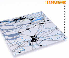 Places with similar names to Messelbroek, Belgium ::
// Misselberg (DE)
Disclaimer :: Information on this page comes without warranty of any kind |
||
|
Where is Messelbroek? Elevation and coordinates ::
Latitude (lat): 51°0'0"N Longitude (lon): 4°56'0"E
Elevation (approx.): 15m (map arrows pan, magnifying glasses zoom) |
||
|
Visiting Messelbroek? Hotel/Accommodation ::
Book a hotel in Messelbroek Travel Guide ::
Buy a travel guide for Belgium rental cars ::
car rental offers GPS waypoint ::
download a GPX waypoint (PoI) of Messelbroek for your GPS receiver
|
||